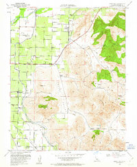
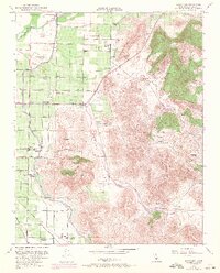
1951 Map of Rocky Hill
USGS Topo · Published 1963About this map
The agricultural and industrial transition of Tulare County is evident in this mid-century landscape where the Kaweah River and its complex system of irrigation channels, including the Peoples Ditch and Friant-Kern Canal, sustain the valley floor. Three distinct rail lines—the Atchison Topeka and Santa Fe Railway, the Southern Pacific Railroad, and the Visalia Electric Railroad—converge to serve the citrus groves and packing houses of Merryman and Lindcove. A unique cultural layer is preserved at Dumtah (Indian Camp Ground Site) near the base of Monument Hill, contrasting with the evolving educational landscape of the rural district, represented by the active Kaweah Sch and the Rocky Hill Sch (Abandoned) located further south near Sides.
Find a feature on this map
47 named features on this map. Tap any name to fly to it.
Don’t see what you’re looking for? This feature index may not catch every label — zoom into the map to look around manually.
Map Details
Editions of this 1951 Rocky Hill Map
5 editions found
Other maps of this area

1904 · Kaweah
USGS Topo · 1:125,000

1909 · Kaweah
USGS Topo · 1:125,000

1925 · Rocky Hill
USGS Topo · 1:31,680

1926 · Ivanhoe
USGS Topo · 1:31,680

1926 · Exeter
USGS Topo · 1:31,680

1927 · Cairns Corner
USGS Topo · 1:31,680

1927 · Rocky Hill
USGS Topo · 1:31,680

1928 · Lemon Cove
USGS Topo · 1:31,680

1928 · Lindsay
USGS Topo · 1:31,680

1937 · Kaweah
USGS Topo · 1:125,000