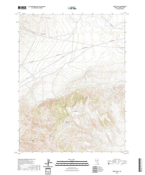
2021 Map of Rocky Hills
USGS Topo · Published 2021About this map
The Simpson Park Mountains and the Rocky Hills dominate this high-desert landscape in Eureka County, Nevada. This topographic study documents a network of vital water sources in an arid environment, including named points such as Cadet Trough Spring, Rocky Hill Spring, and Geyser Canyon Spring. The northern portion of the quadrangle shows the lower-elevation Pine Valley, where the J D Ranch Rd and Cortez Beowawe Rd intersect, marking the sparse transportation corridors of the Great Basin. Deep canyons like Coal Canyon, Trail Canyon, and Fye Canyon carve through the central and southern peaks, while Twin Peaks serves as a prominent landmark for the area. The map illustrates a landscape shaped by intermittent drainages such as Pine Cr and Horse Cr, essential for the ranching and resource activities that define this part of the state.
Find a feature on this map
29 named features on this map. Tap any name to fly to it.
Don’t see what you’re looking for? This feature index may not catch every label — zoom into the map to look around manually.
Map Details
Editions of this 2021 Rocky Hills Map
This is the sole edition of this map. No revisions or reprints were ever made.
Other maps of this area

1926 · Roberts Mountains
USGS Topo · 1:250,000

1929 · Roberts Mountains
USGS Topo · 1:250,000

1938 · Cortez
USGS Topo · 1:48,000

1944 · Cortez
USGS Topo · 1:62,500

1949 · Roberts Creek Mtn
USGS Topo · 1:62,500

1951 · Roberts Creek Mtn
USGS Topo · 1:62,500

1955 · Millett
USGS Topo · 1:250,000

1955 · Winnemucca
USGS Topo · 1:250,000

1956 · Walti Hot Springs
USGS Topo · 1:62,500

1957 · Horse Creek Valley
USGS Topo · 1:62,500