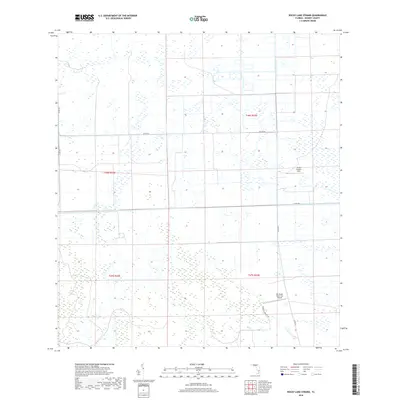
2018 Map of Rocky Lake Strand
USGS Topo · Published 2018About this map
Rocky Lake Strand characterizes this section of Hendry County, defined by its extensive wetland patterns and drainage network. The landscape is marked by the presence of large-scale ranching and private operations, notably the Mc Daniel Ranch Inc Airport and the Devils Garden Strip airfield. These features indicate the region's reliance on aerial access for management and transportation across the difficult terrain. Water management is a primary feature of the area's development, evidenced by the Deer Fence Canal which cuts through the township. The infrastructure is primarily composed of county roads like Co Rd 833 and Co Rd 846, which provide the main arteries through the otherwise sparse and watery interior. This modern survey reflects the ongoing balance between agricultural use and the natural hydrology of southern Florida.
Find a feature on this map
13 named features on this map. Tap any name to fly to it.
Don’t see what you’re looking for? This feature index may not catch every label — zoom into the map to look around manually.
Map Details
Editions of this 2018 Rocky Lake Strand Map
This is the sole edition of this map. No revisions or reprints were ever made.
Other maps of this area

1956 · West Palm Beach
USGS Topo · 1:250,000

1957 · West Palm Beach
USGS Topo · 1:250,000

1958 · West Palm Beach
USGS Topo · 1:250,000

1970 · Lake Harbor SW
USGS Topo · 1:24,000

1970 · La Belle 4 SE
USGS Topo · 1:24,000

1971 · La Belle 4 SW
USGS Topo · 1:24,000

1974 · Everglades 2 SW
USGS Topo · 1:24,000

1974 · Immokalee 1 SW
USGS Topo · 1:24,000

1974 · Immokalee 1 SE
USGS Topo · 1:24,000

1974 · Immokalee 1 NE
USGS Topo · 1:24,000