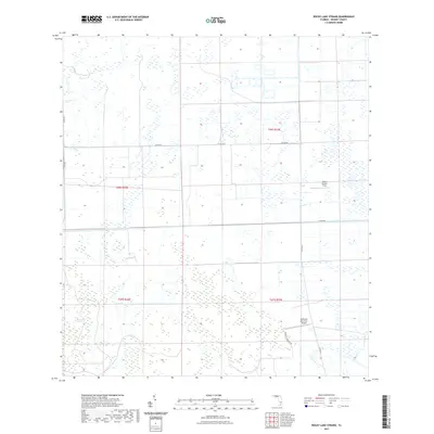
2021 Map of Rocky Lake Strand
USGS Topo · Published 2021About this map
Rocky Lake Strand characterizes this section of Hendry County, Florida, where the natural hydrology of the Everglades meets organized agricultural land management. The landscape is defined by its drainage and transport patterns, notably the Deer Fence Canal and the Devils Garden Strip, which reflect the region's mid-century shift toward large-scale ranching and citrus production. Transportation is primarily limited to secondary routes like Co Rd 833 and McDaniels Private Rd, which facilitate movement between rural homesteads and agricultural operations. Aviation history in this remote pocket is represented by the McDaniel Ranch Inc Airport, indicating the scale of the private landholdings in the area. The map illustrates the grid-based township and range system, including t46s r32e and t47s r33e, which govern the property boundaries in this sparsely populated interior.
Find a feature on this map
12 named features on this map. Tap any name to fly to it.
Don’t see what you’re looking for? This feature index may not catch every label — zoom into the map to look around manually.
Map Details
Editions of this 2021 Rocky Lake Strand Map
This is the sole edition of this map. No revisions or reprints were ever made.
Other maps of this area

1956 · West Palm Beach
USGS Topo · 1:250,000

1957 · West Palm Beach
USGS Topo · 1:250,000

1958 · West Palm Beach
USGS Topo · 1:250,000

1970 · Lake Harbor SW
USGS Topo · 1:24,000

1970 · La Belle 4 SE
USGS Topo · 1:24,000

1971 · La Belle 4 SW
USGS Topo · 1:24,000

1974 · Everglades 2 SW
USGS Topo · 1:24,000

1974 · Immokalee 1 SW
USGS Topo · 1:24,000

1974 · Immokalee 1 SE
USGS Topo · 1:24,000

1974 · Immokalee 1 NE
USGS Topo · 1:24,000