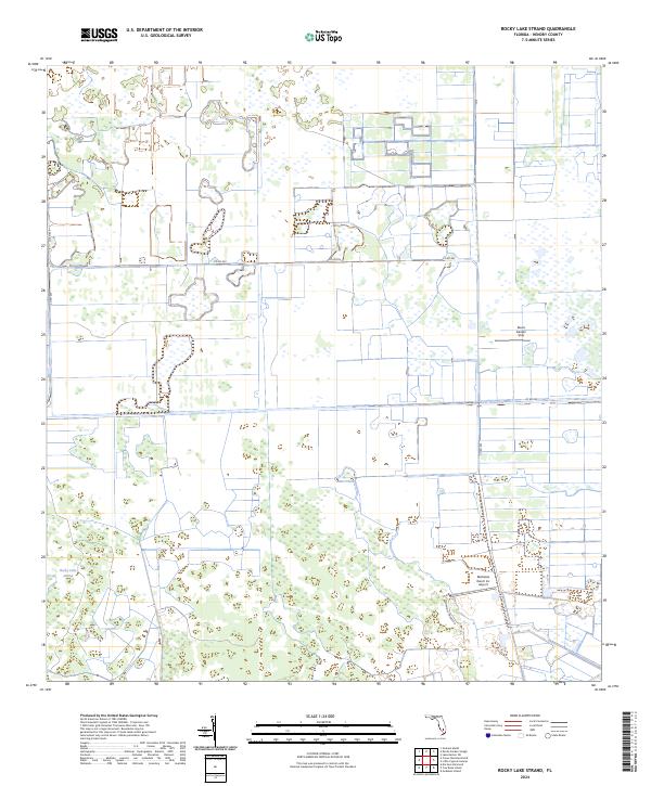
2024 Map of Rocky Lake Strand
USGS Topo · Published 2024About this map
The low-lying wetlands of Hendry County define this modern landscape, where the Rocky Lake Strand and numerous unnamed marshes dominate the terrain. Historically part of the larger Everglades ecosystem, the area is organized by a grid of agricultural and drainage infrastructure, most notably the Deer Fence Canal and a network of county roads. The McDaniel Ranch Inc Airport serves as a primary point of human activity in this sparsely populated interior, supporting the large-scale ranching operations that have long characterized the region. Along the eastern edge, the Devils Garden Strip suggests the legacy of local land divisions in a territory defined by high water tables and seasonal flow ways. The transition between the wet strands and managed ranch lands is visible through the positioning of Co Rd 833 and McDaniels Private Rd, which provide access through the complex hydrology of the Florida interior.
Find a feature on this map
12 named features on this map. Tap any name to fly to it.
Don’t see what you’re looking for? This feature index may not catch every label — zoom into the map to look around manually.
Map Details
Editions of this 2024 Rocky Lake Strand Map
This is the sole edition of this map. No revisions or reprints were ever made.
Other maps of this area

1956 · West Palm Beach
USGS Topo · 1:250,000

1957 · West Palm Beach
USGS Topo · 1:250,000

1958 · West Palm Beach
USGS Topo · 1:250,000

1970 · Lake Harbor SW
USGS Topo · 1:24,000

1970 · La Belle 4 SE
USGS Topo · 1:24,000

1971 · La Belle 4 SW
USGS Topo · 1:24,000

1974 · Everglades 2 SW
USGS Topo · 1:24,000

1974 · Immokalee 1 SW
USGS Topo · 1:24,000

1974 · Immokalee 1 SE
USGS Topo · 1:24,000

1974 · Immokalee 1 NE
USGS Topo · 1:24,000