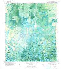
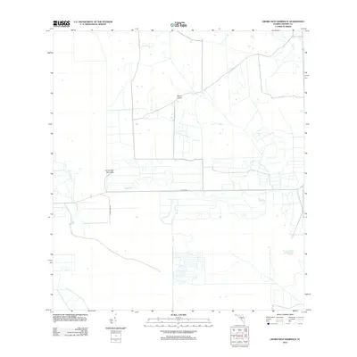
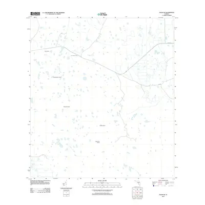
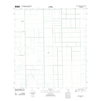
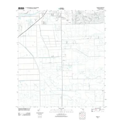
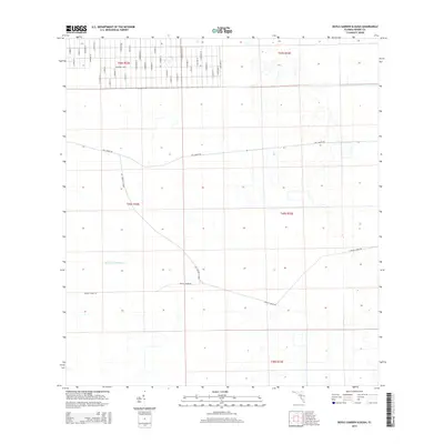
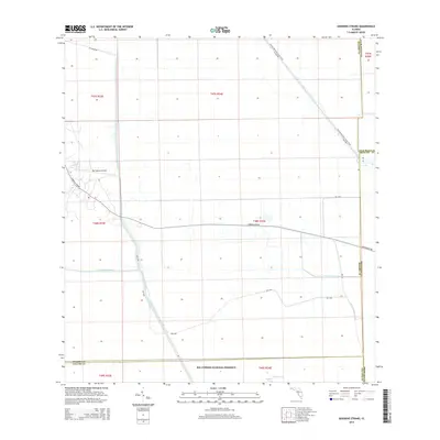
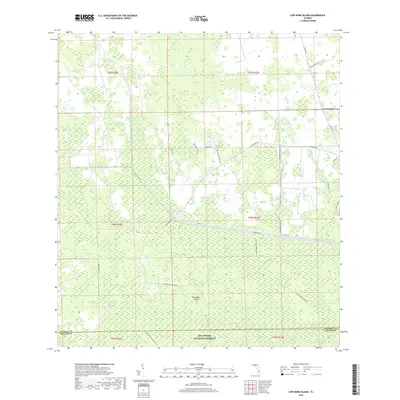
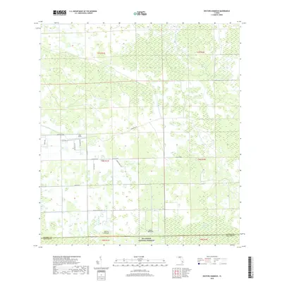
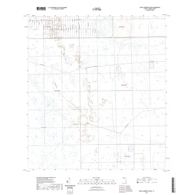
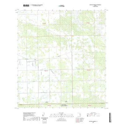
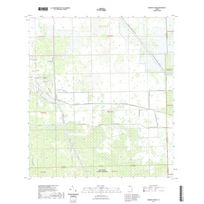
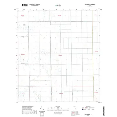
1974 Map of Rocky Lake Strand
USGS Topo · Published 1993About this map
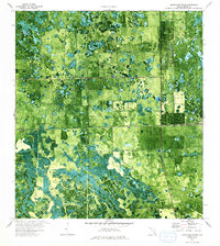
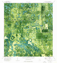
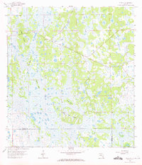
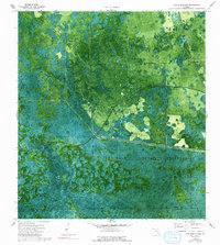
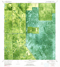
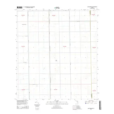
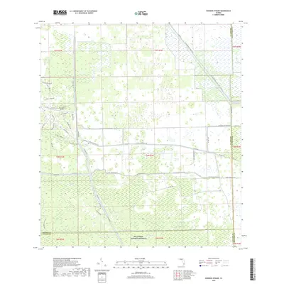
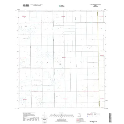
Point of Cypress stands as a focal point in this 1974 orthophotomap of the Hendry County interior, where the transition between natural wetlands and early agricultural drainage is clearly visible. The landscape is defined by a dense mosaic of cypress heads and marshy depressions, interrupted by the straight-line engineering of the Deer Fence Canal. In the northwest, Camp Everglades provides a rare point of human habitation in this seasonally inundated terrain. The map's photographic base reveals the precise boundaries of cleared land and utility infrastructure, including a Radio Tower and Sewage Disposal site, alongside an isolated Landing Strip. These features reflect a mid-century period of rural development when aviation and drainage projects began to alter the accessibility and land use of the Florida scrub and strand systems.
Find a feature on this map
41 named features on this map. Tap any name to fly to it.
Don’t see what you’re looking for? This feature index may not catch every label — zoom into the map to look around manually.
Map Details
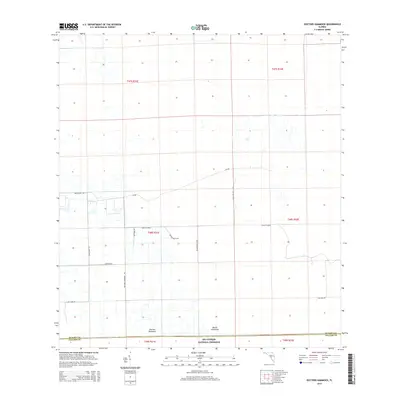
Editions of this 1974 Rocky Lake Strand Map
2 editions found
Historical Maps of Hendry County Through Time
98 maps found
1958 Felda
Hendry County, FL
1958 Felda NE
Hendry County, FL
1958 Felda SE
Hendry County, FL
1958 Sears
Hendry County, FL
1970 Clewiston South
Hendry County, FL
1970 Devils Garden Slough
Hendry County, FL
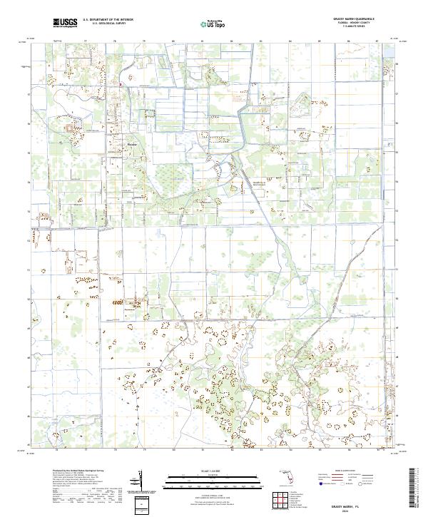
1970 Grassy Marsh
Hendry County, FL
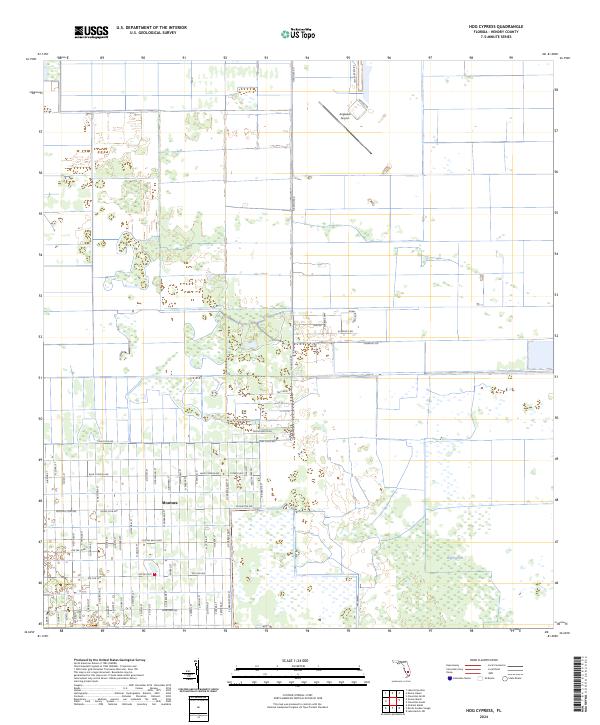
1970 Hog Cypress
Hendry County, FL
1970 Lake Harbor SW
Hendry County, FL
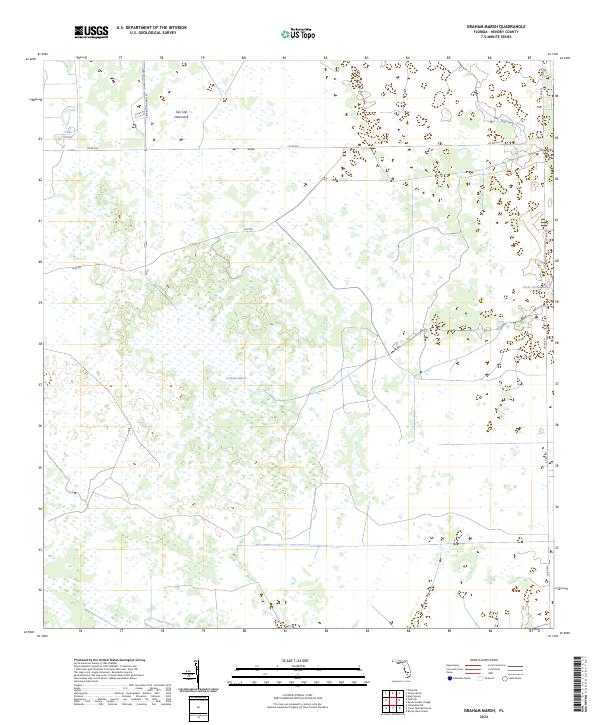
1971 Graham Marsh
Hendry County, FL
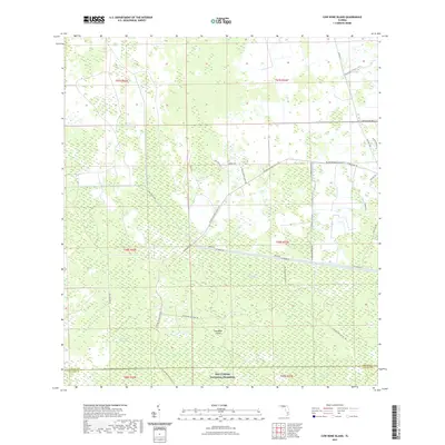
1974 Cow Bone Island
Hendry County, FL
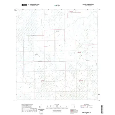
1974 Crows Nest Hammock
Hendry County, FL
1974 Doctors Hammock
Hendry County, FL
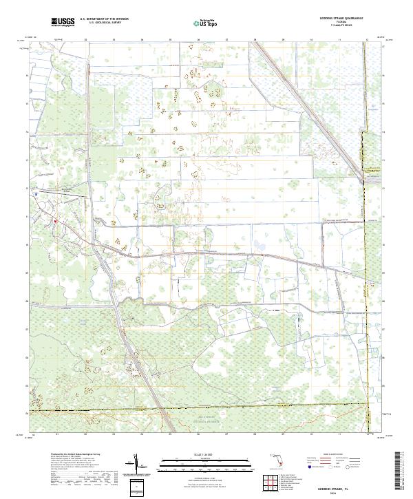
1974 Goddens Strand
Hendry County, FL
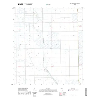
1974 Little Cypress Swamp
Hendry County, FL
1974 Rocky Lake Strand
Hendry County, FL
1994 Lake Harbor SW
Hendry County, FL
2012 Clewiston South
Hendry County, FL
2012 Cow Bone Island
Hendry County, FL
2012 Crows Nest Hammock
Hendry County, FL
2012 Devils Garden Slough
Hendry County, FL

2012 Doctors Hammock
Hendry County, FL
2012 Felda
Hendry County, FL
2012 Felda NE
Hendry County, FL
2012 Felda SE
Hendry County, FL
2012 Goddens Strand
Hendry County, FL
2012 Graham Marsh
Hendry County, FL
2012 Grassy Marsh
Hendry County, FL
2012 Hog Cypress
Hendry County, FL
2012 Lake Harbor SW
Hendry County, FL
2012 Little Cypress Swamp
Hendry County, FL
2012 Rocky Lake Strand
Hendry County, FL
2012 Sears
Hendry County, FL
2015 Clewiston South
Hendry County, FL
2015 Cow Bone Island
Hendry County, FL
2015 Crows Nest Hammock
Hendry County, FL
2015 Devils Garden Slough
Hendry County, FL
2015 Doctors Hammock
Hendry County, FL

2015 Felda
Hendry County, FL
2015 Felda NE
Hendry County, FL
2015 Felda SE
Hendry County, FL
2015 Goddens Strand
Hendry County, FL
2015 Graham Marsh
Hendry County, FL
2015 Grassy Marsh
Hendry County, FL
2015 Hog Cypress
Hendry County, FL
2015 Lake Harbor SW
Hendry County, FL
2015 Little Cypress Swamp
Hendry County, FL
2015 Rocky Lake Strand
Hendry County, FL
2015 Sears
Hendry County, FL
2018 Clewiston South
Hendry County, FL
2018 Cow Bone Island
Hendry County, FL
2018 Crows Nest Hammock
Hendry County, FL
2018 Devils Garden Slough
Hendry County, FL
2018 Doctors Hammock
Hendry County, FL
2018 Felda
Hendry County, FL
2018 Felda NE
Hendry County, FL
2018 Felda SE
Hendry County, FL
2018 Goddens Strand
Hendry County, FL
2018 Graham Marsh
Hendry County, FL
2018 Grassy Marsh
Hendry County, FL
2018 Hog Cypress
Hendry County, FL
2018 Lake Harbor SW
Hendry County, FL
2018 Little Cypress Swamp
Hendry County, FL
2018 Rocky Lake Strand
Hendry County, FL
2018 Sears
Hendry County, FL
2021 Clewiston South
Hendry County, FL
2021 Cow Bone Island
Hendry County, FL
2021 Crows Nest Hammock
Hendry County, FL
2021 Devils Garden Slough
Hendry County, FL
2021 Doctors Hammock
Hendry County, FL
2021 Felda
Hendry County, FL
2021 Felda NE
Hendry County, FL
2021 Felda SE
Hendry County, FL
2021 Goddens Strand
Hendry County, FL
2021 Graham Marsh
Hendry County, FL
2021 Grassy Marsh
Hendry County, FL
2021 Hog Cypress
Hendry County, FL
2021 Lake Harbor SW
Hendry County, FL
2021 Little Cypress Swamp
Hendry County, FL
2021 Rocky Lake Strand
Hendry County, FL
2021 Sears
Hendry County, FL

2023 Sears
Hendry County, FL
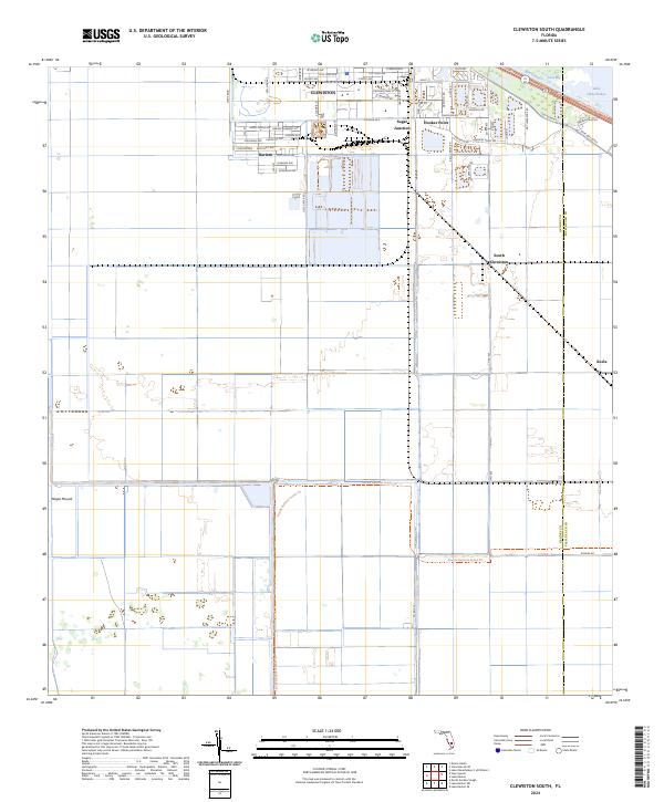
2024 Clewiston South
Hendry County, FL
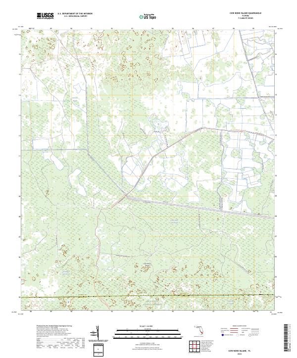
2024 Cow Bone Island
Hendry County, FL
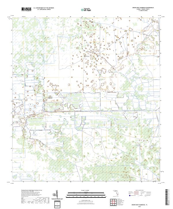
2024 Crows Nest Hammock
Hendry County, FL
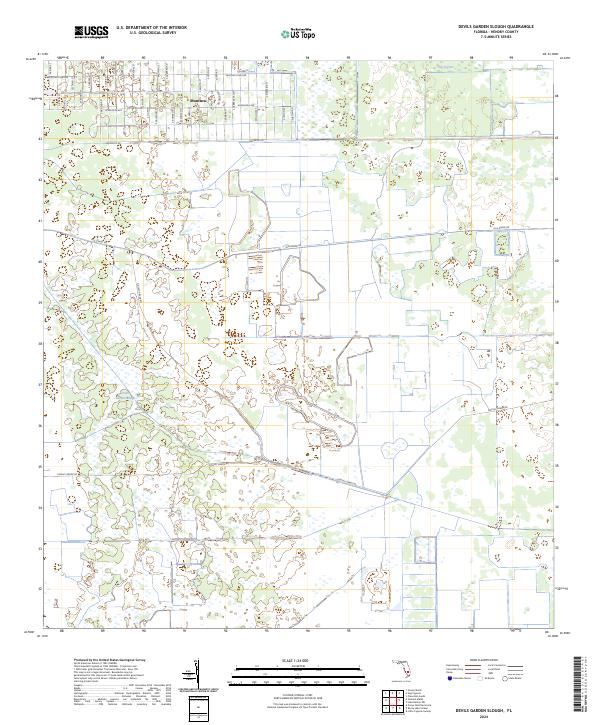
2024 Devils Garden Slough
Hendry County, FL
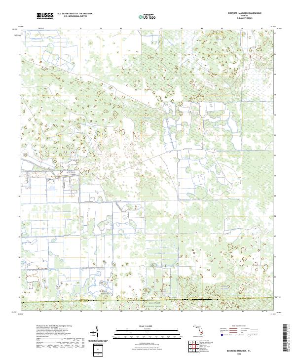
2024 Doctors Hammock
Hendry County, FL
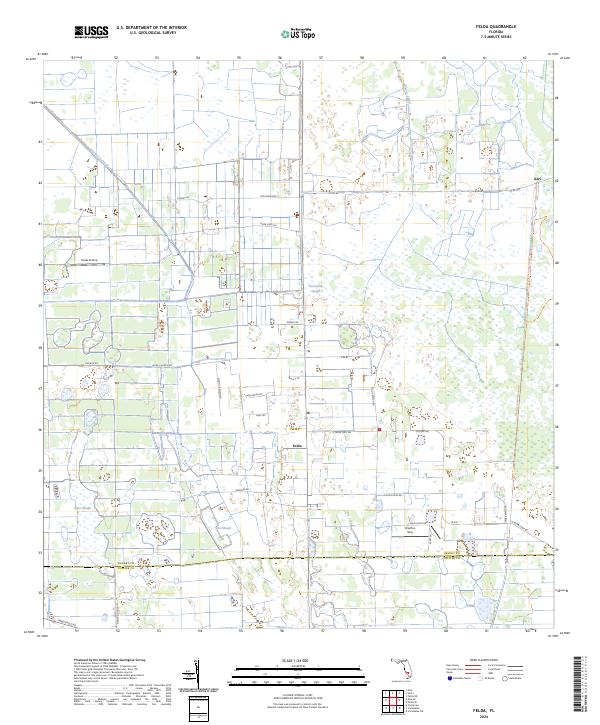
2024 Felda
Hendry County, FL
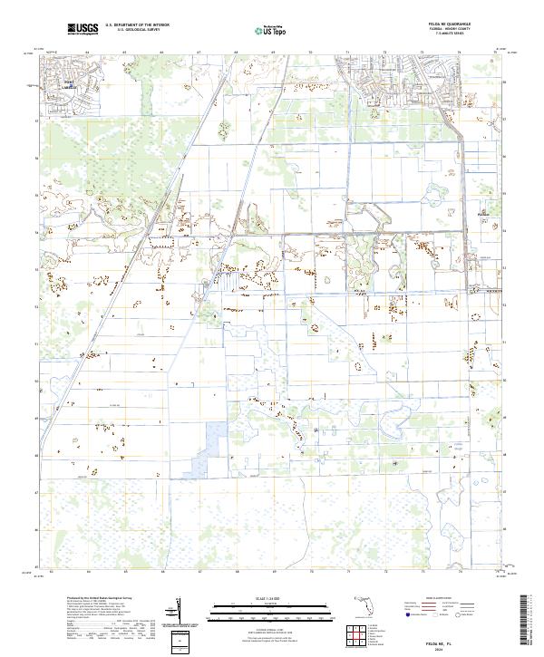
2024 Felda NE
Hendry County, FL
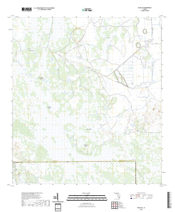
2024 Felda SE
Hendry County, FL
2024 Goddens Strand
Hendry County, FL
2024 Graham Marsh
Hendry County, FL
2024 Grassy Marsh
Hendry County, FL
2024 Hog Cypress
Hendry County, FL
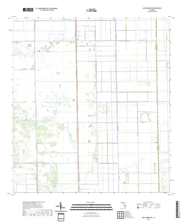
2024 Lake Harbor SW
Hendry County, FL
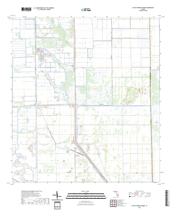
2024 Little Cypress Swamp
Hendry County, FL
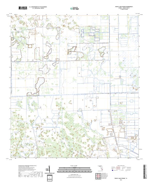
2024 Rocky Lake Strand
Hendry County, FL
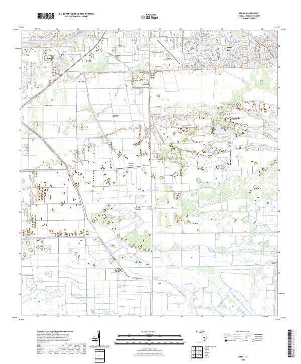
2024 Sears
Hendry County, FL