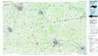
1985 Map of Rocky Mount
USGS Topo · Published 1985About this map
The Tar River and Roanoke River systems dominate this mid-1980s portrait of eastern North Carolina, where the agricultural flatlands meet growing urban hubs. Regional centers like Rocky Mount, Wilson, and Greenville show substantial development, while smaller rail towns such as Tarboro, Farmville, and Pinetops maintain their historic footprints along the Seaboard System and Norfolk Southern lines. The map highlights the sprawling campus of East Carolina University and the specialized installations of the Voice of America transmitter site.
Find a feature on this map
111 named features on this map. Tap any name to fly to it.
Don’t see what you’re looking for? This feature index may not catch every label — zoom into the map to look around manually.
Map Details
Editions of this 1985 Rocky Mount Map
2 editions found
Other maps of this area

1901 · Parmele
USGS Topo · 1:62,500

1901 · Williamston
USGS Topo · 1:62,500

1902 · Kenly
USGS Topo · 1:62,500

1902 · Williamston
USGS Topo · 1:62,500

1902 · Parmele
USGS Topo · 1:62,500

1902 · Ayden
USGS Topo · 1:62,500

1902 · Rocky Mount
USGS Topo · 1:62,500

1902 · Spring Hope
USGS Topo · 1:62,500

1902 · Vanceboro
USGS Topo · 1:62,500

1902 · Tarboro
USGS Topo · 1:62,500