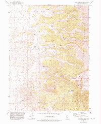
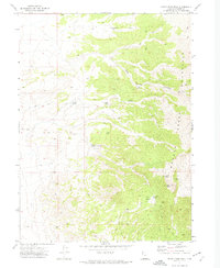
1991 Map of Rocky Pass Peak
USGS Topo · Published 1992About this map
Grouse Creek Mountains topography dominates this 1990s survey, illustrating a landscape defined by its critical water sources and mineral exploration. High-elevation points like Rocky Pass Peak and the nearby Rocky Pass overlook a network of intermittent springs, including Keg Spring, Cluster Springs, and Willow Springs, which provided essential resources in this arid terrain. The presence of numerous labeled Prospect sites and a Mine near the eastern boundary indicates the area's history of geological prospecting, while the Gravel Pit to the west points toward more recent industrial use.
Find a feature on this map
26 named features on this map. Tap any name to fly to it.
Don’t see what you’re looking for? This feature index may not catch every label — zoom into the map to look around manually.
Map Details
Editions of this 1991 Rocky Pass Peak Map
This is the sole edition of this map. No revisions or reprints were ever made.
Other maps of this area

1954 · Brigham City
USGS Topo · 1:250,000

1958 · Brigham City
USGS Topo · 1:250,000

1962 · Brigham City
USGS Topo · 1:250,000
1967 · Lucin NW
USGS Topo · 1:24,000

1967 · Lucin NE
USGS Topo · 1:24,000

1971 · Emigrant Pass
USGS Topo · 1:24,000
1971 · Toms Cabin Spring
USGS Topo · 1:24,000

1971 · Potters Creek
USGS Topo · 1:24,000
1971 · Grouse Creek
USGS Topo · 1:24,000
1971 · Rocky Pass Peak
USGS Topo · 1:24,000