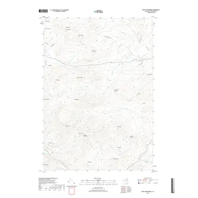
2019 Map of Rocky Peak Ridge
USGS Topo · Published 2019About this map
Rocky Peak Ridge dominates this high-elevation terrain in Essex County, forming a continuous spine of peaks and gaps that define the drainage patterns of the high peaks. The landscape is characterized by prominent summits like Giant Mtn and Hurricane Mtn, with deep depressions and high-altitude water bodies such as Marie Louise Pond and the uniquely named Giant Washbowl. Waterways like the Boquet River and its various tributaries, including Beede Brook and Roaring Brook, carve through the complex topography, eventually feeding into significant natural landmarks like Split Rock Falls.
Find a feature on this map
54 named features on this map. Tap any name to fly to it.
Don’t see what you’re looking for? This feature index may not catch every label — zoom into the map to look around manually.
Map Details
Editions of this 2019 Rocky Peak Ridge Map
This is the sole edition of this map. No revisions or reprints were ever made.
Other maps of this area

1894 · Elizabethtown
USGS Topo · 1:62,500

1895 · Elizabethtown
USGS Topo · 1:62,500

1895 · Mt. Marcy
USGS Topo · 1:62,500

1895 · Ausable
USGS Topo · 1:62,500

1896 · Lake Placid
USGS Topo · 1:62,500

1898 · Lake Placid
USGS Topo · 1:62,500

1901 · Elizabethtown
USGS Topo · 1:62,500

1902 · Mt. Marcy
USGS Topo · 1:62,500

1903 · Ausable
USGS Topo · 1:62,500

1950 · Lake Champlain
USGS Topo · 1:250,000