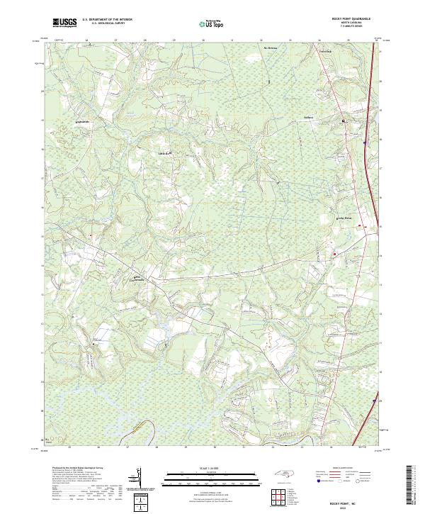
2022 Map of Rocky Point
USGS Topo · Published 2022About this map
The Burgaw Savannah dominates the northern landscape of this region, reflecting the unique ecological and hydrologic character of Pender County's coastal plain. This area is defined by its intricate network of slow-moving water, including Kellys Cr, Ross Cr, and Turkey Cr, which eventually feed into the Northeast Cape Fear River along the southern border. The settlement pattern follows the higher ground and major transit corridors, with established communities like Rocky Point and St. Helena serving as local hubs. For those tracing family history, the map specifically identifies local landmarks such as Rileys Creek Cem and Hocutt Cem. The transition from the rural crossroads at Bells Crossroads to the more developed pockets at Ashton and Twin Oak provides a clear view of how modern infrastructure and traditional land use coexist in this part of North Carolina.
Find a feature on this map
104 named features on this map. Tap any name to fly to it.
Don’t see what you’re looking for? This feature index may not catch every label — zoom into the map to look around manually.
Map Details
Editions of this 2022 Rocky Point Map
This is the sole edition of this map. No revisions or reprints were ever made.
Other maps of this area

1942 · Burgaw
USGS Topo · 1:62,500

1947 · Rocky Point
USGS Topo · 1:62,500

1953 · Florence
USGS Topo · 1:250,000

1953 · Beaufort
USGS Topo · 1:250,000

1954 · Florence
USGS Topo · 1:250,000

1954 · Beaufort
USGS Topo · 1:250,000

1954 · Acme
USGS Topo · 1:62,500

1955 · Atkinson
USGS Topo · 1:62,500

1970 · Scotts Hill
USGS Topo · 1:24,000
1970 · Castle Hayne
USGS Topo · 1:24,000