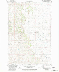
1982 Map of Rocky Ridge North
USGS Topo · Published 1983About this map
Little Missouri National Grassland dominates this landscape in western North Dakota, where the drainages of Davis Creek and Adobe Wall Creek carve through the Badlands. The map reveals a transition from livestock grazing to energy extraction, marked by the presence of an Oil Field, a Scoria Pit, and several wells. Prominent geological formations like Flat Top Butte, Windy Butte, and Chocolate Butte serve as critical navigation points across the broken terrain. In the south, the boundary between Billings Co and Slope Co passes near Peaceful Valley, while the Smith Cem remains as a quiet marker of early homesteading history in the South Fork Bull Creek area. The network of unimproved roads and cattle trails emphasizes the area's rural character during the early 1980s.
Find a feature on this map
23 named features on this map. Tap any name to fly to it.
Don’t see what you’re looking for? This feature index may not catch every label — zoom into the map to look around manually.
Map Details
Editions of this 1982 Rocky Ridge North Map
This is the sole edition of this map. No revisions or reprints were ever made.
Other maps of this area

1953 · Dickinson
USGS Topo · 1:250,000

1957 · Dickinson
USGS Topo · 1:250,000

1961 · Daglum
USGS Topo · 1:62,500

1961 · Rocky Ridge
USGS Topo · 1:62,500

1962 · Tracy Mountain
USGS Topo · 1:24,000

1962 · Belfield SW
USGS Topo · 1:24,000

1962 · Fryburg
USGS Topo · 1:24,000

1980 · Belfield
USGS Topo · 1:100,000
1982 · Daglum NW
USGS Topo · 1:24,000
1982 · Daglum SW
USGS Topo · 1:24,000