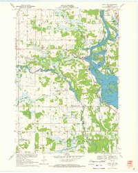
1970 Map of Rocky Run
USGS Topo · Published 1972About this map
The Wisconsin River dominates the eastern edge of this landscape, carving through the townships of Dewey, Hull, and Carson at the dawn of the 1970s. The river's flow is punctuated by backwaters and inlets, most notably First Lake and Second Lake, which sit adjacent to the winding channel of Mill Creek. The interior terrain is a mixture of agriculture and wetlands, with the large Fogarty Marsh and various smaller marshes dotting the border between Portage and Wood counties.
Find a feature on this map
22 named features on this map. Tap any name to fly to it.
Don’t see what you’re looking for? This feature index may not catch every label — zoom into the map to look around manually.
Map Details
Editions of this 1970 Rocky Run Map
2 editions found
Other maps of this area

1955 · Green Bay
USGS Topo · 1:250,000

1956 · Milladore
USGS Topo · 1:48,000

1956 · Stevens Point
USGS Topo · 1:48,000

1957 · Wisconsin Rapids
USGS Topo · 1:48,000

1957 · Whiting
USGS Topo · 1:48,000

1967 · Wisconsin Rapids
USGS Topo · 1:62,500

1970 · Junction City
USGS Topo · 1:24,000

1970 · Stevens Point
USGS Topo · 1:24,000
1970 · Meehan
USGS Topo · 1:24,000
1970 · Dewey Marsh
USGS Topo · 1:24,000