
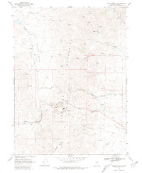
1968 Map of Rodeo Creek NE
USGS Topo · Published 1971About this map
Industrial gold mining operations and rugged high-desert topography characterize this 1968 survey of the borderlands between Elko and Eureka counties. The Carlin Mine serves as a major focal point, surrounded by heavy infrastructure including a Tailings Pond, a complex Aqueduct system, and a prominent Mine Dump. This landscape demonstrates the massive scale of late-20th-century open-pit mining at the height of the Nevada gold boom, contrasting sharply with the older, smaller-scale workings like the Blue Star Mine and Big Six Mine to the north.
Find a feature on this map
31 named features on this map. Tap any name to fly to it.
Don’t see what you’re looking for? This feature index may not catch every label — zoom into the map to look around manually.
Map Details
Editions of this 1968 Rodeo Creek NE Map
2 editions found
Other maps of this area

1955 · McDermitt
USGS Topo · 1:250,000

1955 · Winnemucca
USGS Topo · 1:250,000

1958 · Winnemucca
USGS Topo · 1:250,000

1959 · McDermitt
USGS Topo · 1:250,000

1962 · Winnemucca
USGS Topo · 1:250,000

1968 · Rodeo Creek SW
USGS Topo · 1:24,000

1968 · Welches Canyon
USGS Topo · 1:24,000

1968 · Swales Mountain NW
USGS Topo · 1:24,000

1968 · Rodeo Creek NW
USGS Topo · 1:24,000
1968 · Schroeder Mtn
USGS Topo · 1:24,000