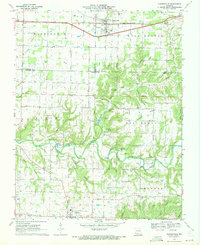
1970 Map of Rogersville
USGS Topo · Published 1971About this map
Rogersville serves as the primary hub on this Ozarks landscape, positioned where the St Louis - San Francisco railroad cuts through the northern townships of Washington and West Benton. The map documents a predominantly rural and agricultural environment during the late 1960s, defined by its complex network of springs, caves, and hollows. Water is central to the local geography, from the meandering Finley Creek and its many tributaries like Pedelo Creek and Johnson Creek to the recreational waters of Lindenture Lake.
Find a feature on this map
56 named features on this map. Tap any name to fly to it.
Don’t see what you’re looking for? This feature index may not catch every label — zoom into the map to look around manually.
Map Details
Editions of this 1970 Rogersville Map
3 editions found
Other maps of this area

1884 · Springfield
USGS Topo · 1:125,000

1886 · Springfield
USGS Topo · 1:125,000

1907 · Forsyth
USGS Topo · 1:125,000

1937 · Galloway
USGS Topo · 1:24,000

1937 · Bradleyville
USGS Topo · 1:48,000

1937 · Ozark
USGS Topo · 1:48,000

1939 · Fordland
USGS Topo · 1:62,500

1942 · Fordland
USGS Topo · 1:62,500

1943 · Ozark
USGS Topo · 1:62,500

1943 · Bradleyville
USGS Topo · 1:62,500