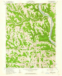
1961 Map of Rokeby Lock
USGS Topo · Published 1962About this map
The Muskingum River corridor in Morgan County defines this early 1960s landscape, where river-dependent infrastructure like Rokeby Lock sits adjacent to the Baltimore and Ohio railroad. This region is characterized by a high density of small family and community burial grounds, including Dutch Hill Cem, Anderson Cem, and Locust Grove Cem, which serve as vital markers for genealogical research. The terrain transitions from the river valley into the wooded ridges of the Wayne National Forest. Rural life is centered around small crossroads like Eagleport, Tridelphia, and Morganville. Along the riverbanks, mid-century culture is represented by the Drive-in Theater, while the presence of scattered Gas Wells indicates the ongoing extractive economy that shaped the interior townships of York, Bloom, and Deerfield.
Find a feature on this map
40 named features on this map. Tap any name to fly to it.
Don’t see what you’re looking for? This feature index may not catch every label — zoom into the map to look around manually.
Map Details
Editions of this 1961 Rokeby Lock Map
4 editions found
Other maps of this area

1910 · Philo
USGS Topo · 1:62,500

1910 · Zanesville
USGS Topo · 1:62,500

1910 · Mc Connelsville
USGS Topo · 1:62,500

1911 · New Lexington
USGS Topo · 1:62,500

1947 · Columbus
USGS Topo · 1:250,000

1949 · Clarksburg
USGS Topo · 1:250,000

1956 · Clarksburg
USGS Topo · 1:250,000

1961 · Columbus
USGS Topo · 1:250,000

1961 · Clarksburg
USGS Topo · 1:250,000

1961 · Mc Connelsville
USGS Topo · 1:24,000