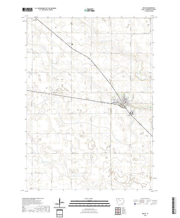
2022 Map of Rolfe
USGS Topo · Published 2022About this map
The town of Rolfe serves as the primary hub on this Pocahontas County landscape, situated at the junction of several drainage systems. The town’s layout is defined by a grid including Broad St, Walnut St, and Des Moines Ave, and it is connected to the surrounding countryside by the Three Rivers Trl. This recreational corridor repurposes an older transportation route, reflecting the transition of the regional economy. Beyond the town limits, the terrain is characterized by the meandering paths of Beaver Cr, Crooked Cr, and the N Br Lizard Cr, which dictate the placement of roads and farmstead boundaries.
Find a feature on this map
40 named features on this map. Tap any name to fly to it.
Don’t see what you’re looking for? This feature index may not catch every label — zoom into the map to look around manually.
Map Details
Editions of this 2022 Rolfe Map
This is the sole edition of this map. No revisions or reprints were ever made.
Other maps of this area

1954 · Fort Dodge
USGS Topo · 1:250,000

1957 · Fort Dodge
USGS Topo · 1:250,000

1958 · Fort Dodge
USGS Topo · 1:250,000

1979 · Pocahontas
USGS Topo · 1:24,000

1979 · Gilmore City
USGS Topo · 1:24,000

1979 · Palmer
USGS Topo · 1:24,000

1980 · Rolfe
USGS Topo · 1:24,000

1980 · Havelock
USGS Topo · 1:24,000
1980 · Mallard
USGS Topo · 1:24,000

1980 · Plover
USGS Topo · 1:24,000