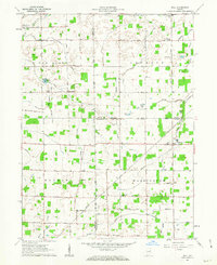
1962 Map of Roll
USGS Topo · Published 1963About this map
Agricultural lands at the intersection of Grant, Wells, and Blackford counties define this early 1960s landscape. Small rural communities like Roll, Arcana, and Van Buren serve as focal points for a network of farm-to-market roads, including the precisely labeled Monroe Road and Casterline Road. The presence of several country burial grounds, such as Baisley Cem and Doyle Cem, along with the Independence Ch and Oak Chapel, highlights the established social fabric of these Indiana townships.
Find a feature on this map
35 named features on this map. Tap any name to fly to it.
Don’t see what you’re looking for? This feature index may not catch every label — zoom into the map to look around manually.
Map Details
Editions of this 1962 Roll Map
3 editions found

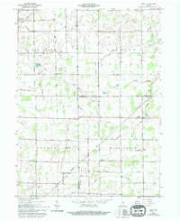
Other maps of this area

1950 · Warren
USGS Topo · 1:24,000

1950 · Mount Etna
USGS Topo · 1:24,000

1951 · Mount Etna
USGS Topo · 1:24,000

1952 · Warren
USGS Topo · 1:24,000

1953 · Muncie
USGS Topo · 1:250,000

1956 · Muncie
USGS Topo · 1:250,000

1960 · Hartford City East
USGS Topo · 1:24,000

1960 · Gas City
USGS Topo · 1:24,000

1960 · Hartford City West
USGS Topo · 1:24,000

1962 · Montpelier
USGS Topo · 1:24,000