
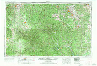
1954 Map of Rolla
USGS Topo · Published 1970About this map
The Ozark Mountains dominate this 1969 revision, showcasing a landscape defined by deep river valleys and significant mineral wealth. The eastern portion of the map highlights the intense industrial activity of the Old Lead Belt and the Iron Range, with labels for the Iron Mountain Mine, Pea Ridge Mine, and Pilot Knob Mine marking the region's geological importance. Mining towns like Bonne Terre, Flat River, and the more modern Viburnum are connected by a network of rails, including the Missouri Pacific RR and the St. Louis-San Francisco RR.
Find a feature on this map
75 named features on this map. Tap any name to fly to it.
Don’t see what you’re looking for? This feature index may not catch every label — zoom into the map to look around manually.
Map Details
Editions of this 1954 Rolla Map
2 editions found
Other maps of this area

1888 · Tuscumbia
USGS Topo · 1:125,000

1894 · Tuscumbia
USGS Topo · 1:125,000

1901 · De Soto
USGS Topo · 1:125,000

1903 · Sullivan
USGS Topo · 1:125,000

1904 · Farmington
USGS Topo · 1:62,500

1905 · Bonneterre
USGS Topo · 1:62,500

1906 · Potosi
USGS Topo · 1:62,500

1906 · Farmington
USGS Topo · 1:62,500

1907 · Weingarten
USGS Topo · 1:62,500

1909 · Weingarten
USGS Topo · 1:62,500