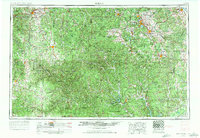
1954 Map of Rolla
USGS Topo · Published 1971About this map
The Ozark Plateau and the ancient granite peaks of the St Francois Mountains dominate this mid-century view of southeastern Missouri. The landscape is defined by its deep timberlands, protected within the sprawling Mark Twain National Forest and Clark National Forest. Settlement patterns follow the rugged topography, with regional hubs like Rolla, Farmington, and Salem serving as anchors for the mining and timber economies. The map highlights the high point of the state at Taum Sauk Mountain and preserves the intricate path of the Current River through the Ozark National Scenic Riverways.
Find a feature on this map
69 named features on this map. Tap any name to fly to it.
Don’t see what you’re looking for? This feature index may not catch every label — zoom into the map to look around manually.
Map Details
Editions of this 1954 Rolla Map
2 editions found

Other maps of this area

1888 · Tuscumbia
USGS Topo · 1:125,000

1894 · Tuscumbia
USGS Topo · 1:125,000

1901 · De Soto
USGS Topo · 1:125,000

1903 · Sullivan
USGS Topo · 1:125,000

1904 · Farmington
USGS Topo · 1:62,500

1905 · Bonneterre
USGS Topo · 1:62,500

1906 · Potosi
USGS Topo · 1:62,500

1906 · Farmington
USGS Topo · 1:62,500

1907 · Weingarten
USGS Topo · 1:62,500

1909 · Weingarten
USGS Topo · 1:62,500