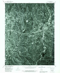
1980 Map of Rolla
USGS Topo · Published 1986About this map
Rolla serves as the focal point of this 1980 orthophotomap, showing the town's expanding footprint against the wooded terrain of central Missouri. The imagery, captured by the U. S. Geological Survey and the Soil Conservation Service, provides a clear view of the urban grid and its surrounding agricultural land. To the west, the settlement of Doolittle sits along the major highway corridor that bisects the landscape, while Northwye marks the northern junction. The southern portion of the quadrangle is defined by the winding course of Little Piney Creek, which cuts through the more heavily forested and dissected hills. By combining aerial photography with traditional land lines from a 1963 survey, this map captures the mid-century transition of the region from rural farmland to a more integrated transportation and residential hub.
Find a feature on this map
7 named features on this map. Tap any name to fly to it.
Don’t see what you’re looking for? This feature index may not catch every label — zoom into the map to look around manually.
Map Details
Editions of this 1980 Rolla Map
2 editions found
Other maps of this area

1912 · Rolla
USGS Topo · 1:62,500

1928 · Meramec Spring
USGS Topo · 1:62,500

1934 · Redbird
USGS Topo · 1:62,500

1937 · Vienna
USGS Topo · 1:62,500

1938 · Redbird
USGS Topo · 1:62,500

1938 · Vienna
USGS Topo · 1:48,000

1949 · Saint Louis
USGS Topo · 1:250,000

1949 · Vienna
USGS Topo · 1:62,500

1949 · Rolla
USGS Topo · 1:250,000

1949 · Meramec Spring
USGS Topo · 1:62,500