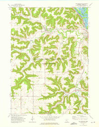
1972 Map of Rollingstone
USGS Topo · Published 1976About this map
Rollingstone and Stockton anchor this 1972 study of the driftless region, where steep valleys and winding creek beds define the local geography. The landscape is characterized by the complex drainage patterns of Rollingstone Creek, Garvin Brook, and Peterson Creek as they cut through the upland ridges of Mount Vernon and Hillsdale. Large portions of the terrain are protected within the Minnesota Memorial Hardwood State Forest, preserving the wooded bluffs that rise sharply above the river valleys. Evidence of the region’s transport and social history appears in the Chicago and North Western rail lines and the presence of the Immanuel Sch. To the northeast, the map reaches the Upper Mississippi River Wild Life and Fish Refuge, showing the transitional wetlands of Duck Slough near Minnesota City.
Find a feature on this map
35 named features on this map. Tap any name to fly to it.
Don’t see what you’re looking for? This feature index may not catch every label — zoom into the map to look around manually.
Map Details
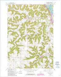
Editions of this 1972 Rollingstone Map
2 editions found
Other maps of this area

1929 · Fountain City
USGS Topo · 1:62,500

1932 · Cochrane
USGS Topo · 1:62,500

1934 · Winona
USGS Topo · 1:62,500

1934 · Cochrane
USGS Topo · 1:62,500

1937 · Winona
USGS Topo · 1:62,500

1937 · Cochrane
USGS Topo · 1:62,500

1953 · Eau Claire
USGS Topo · 1:250,000

1954 · Lewiston
USGS Topo · 1:62,500

1958 · Eau Claire
USGS Topo · 1:250,000

1958 · Houston
USGS Topo · 1:62,500