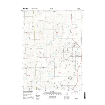
2014 Map of Romeo
USGS Topo · Published 2014About this map
Romeo sits at the eastern edge of this landscape, serving as a primary settlement point where residential grids meet the rural expanse of northern Macomb and Oakland counties. The area is defined by a dense network of glacial lakes and kettle ponds, including Thorington Lake, Cusick Lake, and Inwood Lake, which are connected by complex drainage systems like Price Brook and Stony Creek. A legacy of early settlement is visible through the numerous family and community burial grounds dotting the townships, such as Cooley Cem, Bruce Cem, and the Washington Center Cemetery.
Find a feature on this map
172 named features on this map. Tap any name to fly to it.
Don’t see what you’re looking for? This feature index may not catch every label — zoom into the map to look around manually.
Map Details
Editions of this 2014 Romeo Map
This is the sole edition of this map. No revisions or reprints were ever made.
Other maps of this area

1908 · Rochester
USGS Topo · 1:62,500

1912 · Mt Clemens
USGS Topo · 1:62,500

1914 · Armada
USGS Topo · 1:62,500

1928 · Armada
USGS Topo · 1:62,500

1929 · Mt Clemens
USGS Topo · 1:62,500

1936 · Rochester
USGS Topo · 1:31,680

1936 · Washington
USGS Topo · 1:31,680

1936 · Waldenburg
USGS Topo · 1:31,680

1943 · Lake Orion
USGS Topo · 1:24,000

1943 · Romeo
USGS Topo · 1:24,000
Featured Places
- Washington Charter Township, MI
- Oakland Charter Township, MI
- Addison Township, MI
- Romeo, MI
- Clifton Mill, Washington Charter Township