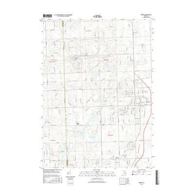
2017 Map of Romeo
USGS Topo · Published 2017About this map
The village of Romeo serves as a primary hub on this survey, situated at the junction of several historic routes along the border of Oakland Co and Macomb Co. The landscape is characterized by a series of kettle lakes and drainages, including Thorington Lake, Cusick Lake, and Fisher Lake, reflecting the region's glacial origins. A notable industrial and historical marker is found at Clifton Mill on the banks of Stony Creek, while the Macomb Orchard Rail Trail traces a former rail corridor through the heart of the township. For those researching local heritage, several burial grounds are scattered across the terrain, from the centralized Romeo Cem to the rural Brabb Cem and Clifton Cem. The northern portion of the map is punctuated by Twombly Mtn and the sprawling military Proving Ground, illustrating a mix of natural topography and large-scale land use.
Find a feature on this map
171 named features on this map. Tap any name to fly to it.
Don’t see what you’re looking for? This feature index may not catch every label — zoom into the map to look around manually.
Map Details
Editions of this 2017 Romeo Map
This is the sole edition of this map. No revisions or reprints were ever made.
Other maps of this area

1908 · Rochester
USGS Topo · 1:62,500

1912 · Mt Clemens
USGS Topo · 1:62,500

1914 · Armada
USGS Topo · 1:62,500

1928 · Armada
USGS Topo · 1:62,500

1929 · Mt Clemens
USGS Topo · 1:62,500

1936 · Rochester
USGS Topo · 1:31,680

1936 · Washington
USGS Topo · 1:31,680

1936 · Waldenburg
USGS Topo · 1:31,680

1943 · Lake Orion
USGS Topo · 1:24,000

1943 · Romeo
USGS Topo · 1:24,000
Featured Places
- Washington Charter Township, MI
- Oakland Charter Township, MI
- Addison Township, MI
- Romeo, MI
- Clifton Mill, Washington Charter Township