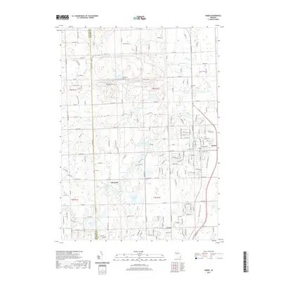
2019 Map of Romeo
USGS Topo · Published 2019About this map
Romeo stands as a primary focal point at the junction of Macomb and Oakland counties, surrounded by a dense network of residential streets and historic cemetery sites. The landscape transitions from the concentrated settlement of Romeo to the more rural character of Clifton Mill, defined by a series of kettle lakes including Inwood Lake, Thorington Lake, and Cusick Lake. This region of southeast Michigan retains a mix of agrarian patterns and modern suburban expansion, with established sections like Clifton Cem and Romeo Cem providing significant genealogical touchpoints. The presence of the Macomb Orchard Rail Trail highlights the repurposing of former transportation corridors, while natural drainage features like Stony Creek and the McClure Drain navigate the local topography. Higher ground is found at Twombly Mtn, offering a contrast to the marshy lowlands surrounding Fisher Lake.
Find a feature on this map
179 named features on this map. Tap any name to fly to it.
Don’t see what you’re looking for? This feature index may not catch every label — zoom into the map to look around manually.
Map Details
Editions of this 2019 Romeo Map
This is the sole edition of this map. No revisions or reprints were ever made.
Other maps of this area

1908 · Rochester
USGS Topo · 1:62,500

1912 · Mt Clemens
USGS Topo · 1:62,500

1914 · Armada
USGS Topo · 1:62,500

1928 · Armada
USGS Topo · 1:62,500

1929 · Mt Clemens
USGS Topo · 1:62,500

1936 · Rochester
USGS Topo · 1:31,680

1936 · Washington
USGS Topo · 1:31,680

1936 · Waldenburg
USGS Topo · 1:31,680

1943 · Lake Orion
USGS Topo · 1:24,000

1943 · Romeo
USGS Topo · 1:24,000
Featured Places
- Washington Charter Township, MI
- Oakland Charter Township, MI
- Addison Township, MI
- Romeo, MI
- Clifton Mill, Washington Charter Township