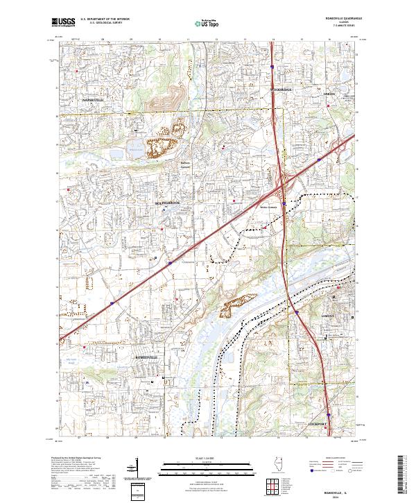
2024 Map of Romeoville
USGS Topo · Published 2024About this map
The Des Plaines River corridor serves as the primary geographical axis for this modern study of Will County's rapidly developed suburban landscape. Established settlements like Bolingbrook, Romeoville, and Lemont anchor a dense network of residential streets and arterial roads that have largely replaced the original agricultural character of the region. Significant industrial and logistics infrastructure now flanks the river and the adjacent rail lines, while preserved natural pockets remain at Whalon Lake and along the Lily Cache Creek drainage.
Find a feature on this map
45 named features on this map. Tap any name to fly to it.
Don’t see what you’re looking for? This feature index may not catch every label — zoom into the map to look around manually.
Map Details
Editions of this 2024 Romeoville Map
This is the sole edition of this map. No revisions or reprints were ever made.
Other maps of this area

1890 · Des Plaines
USGS Topo · 1:62,500

1891 · Riverside
USGS Topo · 1:62,500

1892 · Joliet
USGS Topo · 1:62,500

1893 · Riverside
USGS Topo · 1:62,500

1894 · Des Plaines
USGS Topo · 1:62,500

1900 · Des Plaines
USGS Topo · 1:62,500

1900 · Riverside
USGS Topo · 1:62,500

1901 · Des Plaines
USGS Topo · 1:62,500

1901 · Riverside
USGS Topo · 1:62,500

1908 · Wheaton
USGS Topo · 1:62,500