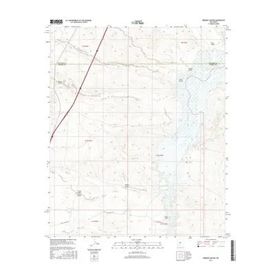
2017 Map of Romero Canyon
USGS Topo · Published 2017About this map
The Rio Grande cuts a wide, braided path through this arid basin, defining the border between t10s r3w and t10s r4w as it flows south toward The Narrows. This high-desert landscape is heavily dissected by drainage networks like San Jose Arroyo and Cuervo Canyon, which feed toward the river valley from the surrounding uplands. The terrain is marked by a series of named canyons, including Carbon Canyon, Gorbon Canyon, and Lumber Canyon, suggesting a history of local resource extraction or geographic landmarks recognized by ranching and timber interests. Human infrastructure is concentrated along the western edge where Interstate 25 and Highway 85 provide the primary north-south corridor. Away from the highway, remote landmarks such as Joe Pankey Reservoir Number 2 and the winding Upper Narrows Rd provide critical points of reference for navigating the canyons and mesas of this central New Mexico landscape.
Find a feature on this map
23 named features on this map. Tap any name to fly to it.
Don’t see what you’re looking for? This feature index may not catch every label — zoom into the map to look around manually.
Map Details
Editions of this 2017 Romero Canyon Map
This is the sole edition of this map. No revisions or reprints were ever made.
Other maps of this area

1954 · Tularosa
USGS Topo · 1:250,000

1958 · Tularosa
USGS Topo · 1:250,000

1961 · Huerfano Hill
USGS Topo · 1:24,000

1961 · Sierra Fijardo
USGS Topo · 1:24,000

1961 · Paraje Well
USGS Topo · 1:24,000

1961 · Black Bluffs
USGS Topo · 1:24,000

1961 · Black Hill
USGS Topo · 1:24,000

1961 · Crocker
USGS Topo · 1:24,000

1961 · Lava
USGS Topo · 1:24,000

1961 · Romero Canyon
USGS Topo · 1:24,000