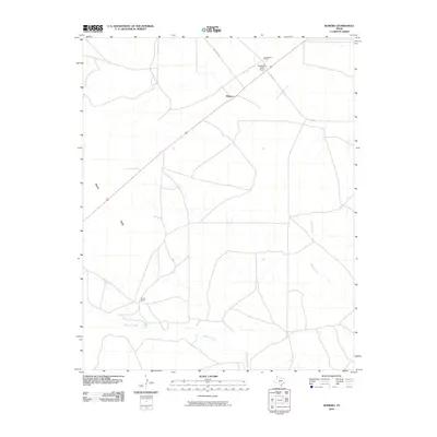
2010 Map of Romero
USGS Topo · Published 2010About this map
Romero serves as the central focal point of this Panhandle landscape, where the intersection of local routes and ranching interests defines the rural geography. The area is characterized by significant agricultural holdings, most notably Castleberry Ranch in the north and Coots Ranch to the southwest. Transportation infrastructure includes the Castleberry Ranch Airport and a network of state roads such as Fm 767 and Fm 787 that traverse the open terrain.
Find a feature on this map
11 named features on this map. Tap any name to fly to it.
Don’t see what you’re looking for? This feature index may not catch every label — zoom into the map to look around manually.
Map Details
Editions of this 2010 Romero Map
This is the sole edition of this map. No revisions or reprints were ever made.
Other maps of this area

1954 · Tucumcari
USGS Topo · 1:250,000

1958 · Tucumcari
USGS Topo · 1:250,000

1971 · Middle Water
USGS Topo · 1:24,000

1971 · Romero SE
USGS Topo · 1:24,000

1971 · Doyle Hill
USGS Topo · 1:24,000

1971 · Amistad SE
USGS Topo · 1:24,000

1971 · Nara Visa
USGS Topo · 1:24,000

1971 · Whiteaker Ranch
USGS Topo · 1:24,000

1971 · Knoblaw
USGS Topo · 1:24,000

1971 · Spring Creek Ranch
USGS Topo · 1:24,000