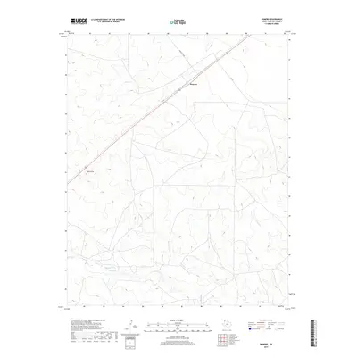
2019 Map of Romero
USGS Topo · Published 2019About this map
Romero sits at a high point in the high plains of the Texas Panhandle, positioned along a major transit corridor through Hartley County. The landscape is defined by the subtle drainage patterns of intermittent watercourses, including the headwaters of Minneosa Cr and Spring Cr. Evidence of the region’s ranching geography is seen in the naming of Bull Spring and the presence of the Sand Hills, which create localized relief in an otherwise expansive terrain. This modern survey illustrates the persistent importance of rural infrastructure, with Ranch Rd 3296 and FM 767 serving as the primary connections between isolated homesteads and larger regional hubs. The placement of Romero at the intersection of these roads and the railway suggests its historical role as a shipping or supply point for the surrounding cattle country.
Find a feature on this map
7 named features on this map. Tap any name to fly to it.
Don’t see what you’re looking for? This feature index may not catch every label — zoom into the map to look around manually.
Map Details
Editions of this 2019 Romero Map
This is the sole edition of this map. No revisions or reprints were ever made.
Other maps of this area

1954 · Tucumcari
USGS Topo · 1:250,000

1958 · Tucumcari
USGS Topo · 1:250,000

1971 · Middle Water
USGS Topo · 1:24,000

1971 · Romero SE
USGS Topo · 1:24,000

1971 · Doyle Hill
USGS Topo · 1:24,000

1971 · Amistad SE
USGS Topo · 1:24,000

1971 · Nara Visa
USGS Topo · 1:24,000

1971 · Whiteaker Ranch
USGS Topo · 1:24,000

1971 · Knoblaw
USGS Topo · 1:24,000

1971 · Spring Creek Ranch
USGS Topo · 1:24,000