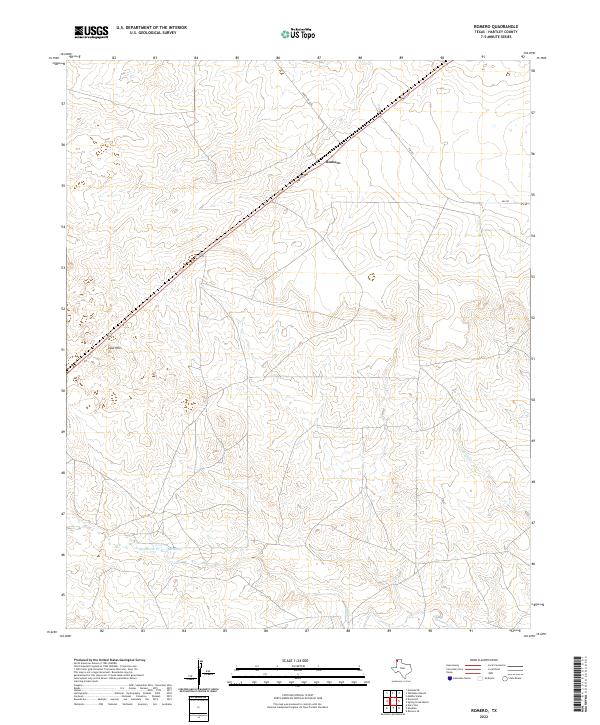
2022 Map of Romero
USGS Topo · Published 2022About this map
Romero serves as the primary landmark on this High Plains landscape in Hartley County, situated along a prominent rail line that cuts diagonally through the Panhandle. The terrain is characterized by the ephemeral drainage of Minneosa Cr and Spring Cr, which define the local topography alongside Bull Spring. The map documents a sparsely settled ranching region where infrastructure is limited to essential connectors like Fm 767 and Ranch Rd 3296. To the southwest, the Sand Hills provide a distinct topographic contrast to the surrounding plains, marking a specific ecological and geological pocket in this rural expanse. This 2022 survey captures the contemporary layout of the region, showing how few settlements like Sand Hills dot the wide-open geography of the western Texas borderlands.
Find a feature on this map
8 named features on this map. Tap any name to fly to it.
Don’t see what you’re looking for? This feature index may not catch every label — zoom into the map to look around manually.
Map Details
Editions of this 2022 Romero Map
This is the sole edition of this map. No revisions or reprints were ever made.
Other maps of this area

1954 · Tucumcari
USGS Topo · 1:250,000

1958 · Tucumcari
USGS Topo · 1:250,000

1971 · Middle Water
USGS Topo · 1:24,000

1971 · Romero SE
USGS Topo · 1:24,000

1971 · Doyle Hill
USGS Topo · 1:24,000

1971 · Amistad SE
USGS Topo · 1:24,000

1971 · Nara Visa
USGS Topo · 1:24,000

1971 · Whiteaker Ranch
USGS Topo · 1:24,000

1971 · Knoblaw
USGS Topo · 1:24,000

1971 · Spring Creek Ranch
USGS Topo · 1:24,000