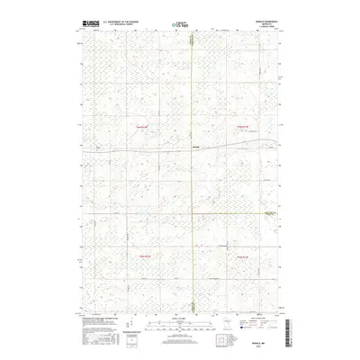
2016 Map of Ronald
USGS Topo · Published 2016About this map
The settlement of Ronald marks a central point in this transition zone where Aitkin, Carlton, and Pine Counties meet. This 2016 survey documents a landscape of extensive wetlands and small watercourses, notably the Split Rock River and Birch Cr, which navigate the low-lying terrain. The human footprint is defined by a sparse but deliberate network of local roads with evocative names like Wagon Wheel Rd and Farm To Market Rd, indicating the area's rural and agricultural heritage. Genealogists will find the Beaver Cem in the western portion of the map, a key landmark for tracing family roots in this corner of Minnesota. The map provides a clear view of the Public Land Survey System divisions, including sections of t46n r22w and t46n r21w, illustrating how the land was partitioned and settled across county lines.
Find a feature on this map
28 named features on this map. Tap any name to fly to it.
Don’t see what you’re looking for? This feature index may not catch every label — zoom into the map to look around manually.
Map Details
Editions of this 2016 Ronald Map
This is the sole edition of this map. No revisions or reprints were ever made.
Other maps of this area

1953 · Duluth
USGS Topo · 1:250,000

1958 · Duluth
USGS Topo · 1:250,000

1961 · Cromwell
USGS Topo · 1:62,500

1961 · Moose Lake
USGS Topo · 1:62,500

1969 · Solana
USGS Topo · 1:24,000

1969 · Arthyde
USGS Topo · 1:24,000

1969 · Split Rock Lake
USGS Topo · 1:24,000

1969 · Ronald
USGS Topo · 1:24,000

1969 · Automba
USGS Topo · 1:24,000

1969 · Lawler
USGS Topo · 1:24,000