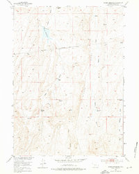
1952 Map of Rongis Reservoir
USGS Topo · Published 1976About this map
Signor Ridge dominates the landscape of this portion of Fremont County, where early 1950s ranching and industrial exploration intersect. Isolated homesteads like Grives Ranch and Myers Ranch are connected by a network of drainage features and unimproved roads, including Logan Gulch and Signor Draw. The map documents early energy activity with Logan Gulch Oil Well No 1 (Aband) and its counterpart, Logan Gulch Oil Well No 2 (Aband), reflecting the push for resource development in the Missouri River Basin during this era.
Find a feature on this map
21 named features on this map. Tap any name to fly to it.
Don’t see what you’re looking for? This feature index may not catch every label — zoom into the map to look around manually.
Map Details
Editions of this 1952 Rongis Reservoir Map
2 editions found
Other maps of this area

1952 · Tin Cup Mountain
USGS Topo · 1:24,000

1952 · Muskrat Basin
USGS Topo · 1:24,000

1952 · Rongis Reservoir SE
USGS Topo · 1:24,000

1952 · Double Butte
USGS Topo · 1:24,000

1952 · Rongis Reservoir
USGS Topo · 1:24,000

1952 · Butte Well
USGS Topo · 1:24,000

1953 · Blue Gulch
USGS Topo · 1:24,000

1953 · Elkhorn Springs
USGS Topo · 1:24,000

1953 · Campbell Ridge
USGS Topo · 1:24,000

1955 · Lander
USGS Topo · 1:250,000