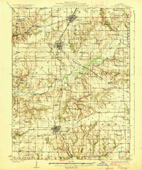
1926 Map of Roodhouse
USGS Topo · Published 1926About this map
Greene County agriculture and rail transit dominate this mid-1920s landscape, centered on the significant junction of the Chicago and Alton and the Chicago Burlington and Quincy railroads. The town of Roodhouse serves as a northern anchor, while Carrollton sits to the south, connected by the burgeoning State Hard Highway. The density of one-room schoolhouses reveals a deeply settled rural society, with uniquely named institutions like Swamp College School and Bending Oak School serving the farming families of White Hall and Wrights.
Find a feature on this map
77 named features on this map. Tap any name to fly to it.
Don’t see what you’re looking for? This feature index may not catch every label — zoom into the map to look around manually.
Map Details
Editions of this 1926 Roodhouse Map
2 editions found
Other maps of this area

1924 · Winchester
USGS Topo · 1:48,000

1924 · Roodhouse
USGS Topo · 1:62,500

1924 · Griggsville
USGS Topo · 1:62,500

1925 · Brighton
USGS Topo · 1:62,500

1926 · Griggsville
USGS Topo · 1:62,500

1926 · Winchester
USGS Topo · 1:62,500

1926 · Roodhouse
USGS Topo · 1:62,500

1928 · Brighton
USGS Topo · 1:62,500

1930 · Pearl
USGS Topo · 1:62,500

1930 · Hardin
USGS Topo · 1:62,500