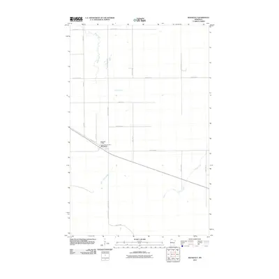
2010 Map of Roosevelt
USGS Topo · Published 2010About this map
Roosevelt sits as the primary settlement on this northern Minnesota landscape, centered at the intersection of Main St and several key regional corridors. The town's local services are anchored by the Roosevelt Post Office and Roosevelt Park, serving a community defined by its proximity to the vast forested tracts of the north. The terrain is characterized by a low-lying, watery environment where Willow Creek meanders through the western half of the quadrangle and Tomato Creek drains the eastern portion. The layout of the road network, including Krull Forest Rd and Krull Trl NW, reflects the area's connection to forestry and land management, while the surrounding grid of county highways and avenues like 690th Ave suggests a sparsely populated region of rural homesteads and agricultural plots.
Find a feature on this map
24 named features on this map. Tap any name to fly to it.
Don’t see what you’re looking for? This feature index may not catch every label — zoom into the map to look around manually.
Map Details
Editions of this 2010 Roosevelt Map
This is the sole edition of this map. No revisions or reprints were ever made.
Other maps of this area

1918 · Winterroad
USGS Topo · 1:62,500

1918 · Roosevelt
USGS Topo · 1:62,500

1918 · Williams
USGS Topo · 1:62,500

1919 · Peppermint Creek
USGS Topo · 1:62,500

1943 · Peppermint Creek
USGS Topo · 1:62,500

1943 · Roosevelt
USGS Topo · 1:62,500

1954 · Roseau
USGS Topo · 1:250,000

1957 · Roseau
USGS Topo · 1:250,000

1958 · Roseau
USGS Topo · 1:250,000

1967 · Williams
USGS Topo · 1:24,000