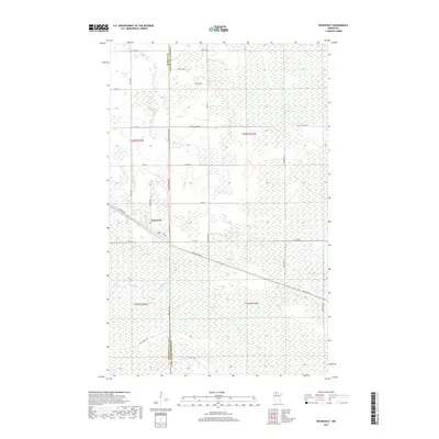
2019 Map of Roosevelt
USGS Topo · Published 2019About this map
The small settlement of Roosevelt sits at the edge of the wetlands along the border of Roseau and Lake of the Woods counties. This landscape is defined by its extensive drainage networks and low-lying terrain, where Willow Cr and Tomato Cr meander through a heavily sectioned rural grid. The map reveals a transition between managed timber lands and open marsh, with several designated forest routes like Cole Forest Rd and Krull Forest Rd providing access to the more remote southern sections. The residential pattern is concentrated around the junction of Kirkwood Dr and the main thoroughfare, showing the town's role as a local crossroads in this northern Minnesota borderland. A series of numbered county roads, including Co Rd 58 and Co St Aid Hwy 8, connect the scattered farmsteads and rural residences to the primary north-south artery of Rocky Point Rd.
Find a feature on this map
35 named features on this map. Tap any name to fly to it.
Don’t see what you’re looking for? This feature index may not catch every label — zoom into the map to look around manually.
Map Details
Editions of this 2019 Roosevelt Map
This is the sole edition of this map. No revisions or reprints were ever made.
Other maps of this area

1918 · Winterroad
USGS Topo · 1:62,500

1918 · Roosevelt
USGS Topo · 1:62,500

1918 · Williams
USGS Topo · 1:62,500

1919 · Peppermint Creek
USGS Topo · 1:62,500

1943 · Peppermint Creek
USGS Topo · 1:62,500

1943 · Roosevelt
USGS Topo · 1:62,500

1954 · Roseau
USGS Topo · 1:250,000

1957 · Roseau
USGS Topo · 1:250,000

1958 · Roseau
USGS Topo · 1:250,000

1967 · Williams
USGS Topo · 1:24,000