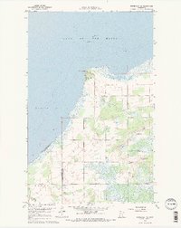
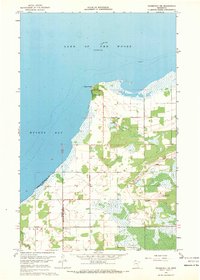
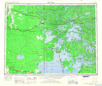
1967 Map of Roosevelt NE
USGS Topo · Published 1969About this map
Arnesen sits prominently on the shoreline of Muskeg Bay, serving as a focal point for this 1967 coastal survey. The map details the transition from the open waters of Lake of the Woods to the low-lying interior wetlands and woodlots of northern Minnesota. Navigation and geological hazards are marked by features like Rocky Point, Gull Rock, and Twin Rocks, which define the rugged northern edge of the land. Further south, the settlement of Laona appears alongside the Mt Carmel Ch and a small Cemetery, indicating a tight-knit rural community near the Willow watercourse. The landscape is heavily marked by industrial extraction, with numerous Gravel Pits scattered throughout the eastern portion of the quadrangle, reflecting the local demand for construction materials in this remote border region.
Find a feature on this map
13 named features on this map. Tap any name to fly to it.
Don’t see what you’re looking for? This feature index may not catch every label — zoom into the map to look around manually.
Map Details
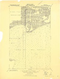
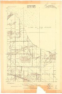
Editions of this 1967 Roosevelt NE Map
2 editions found
Other maps of this area
1918 · Buffalo Bay
USGS Topo · 1:62,500

1918 · Roosevelt
USGS Topo · 1:62,500
1918 · Williams
USGS Topo · 1:62,500

1943 · Roosevelt
USGS Topo · 1:62,500

1954 · Roseau
USGS Topo · 1:250,000

1957 · Roseau
USGS Topo · 1:250,000

1958 · Roseau
USGS Topo · 1:250,000
1963 · Kenora
USGS Topo · 1:250,000
1967 · Williams
USGS Topo · 1:24,000
1967 · Roosevelt NW
USGS Topo · 1:24,000