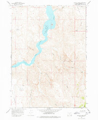
1967 Map of Rooster Comb
USGS Topo · Published 1978About this map
Lake Owyhee dominates this landscape in Malheur County, appearing here shortly after its creation to reveal the high-water line of its inundation. The reservoir winds through steep topography, passing notable landforms like Doe Island and the distinctive Rooster Comb. Inland from the water, the map documents a terrain defined by isolated springs and seasonal drainages, including Mud Spring and Gin Spring, which were vital water sources for early cattle ranching in the high desert. The presence of Barnes Cabin and various jeep trails suggests a history of remote homesteading and grazing. To the east, canyons like Juniper Gulch and The Yellow Jacket showcase the complex geology near the Idaho border, while prominent peaks such as North Table Mtn and Mahogany Mtn serve as permanent navigational anchors for the surrounding basin.
Find a feature on this map
26 named features on this map. Tap any name to fly to it.
Don’t see what you’re looking for? This feature index may not catch every label — zoom into the map to look around manually.
Map Details
Editions of this 1967 Rooster Comb Map
2 editions found
Other maps of this area

1955 · Boise
USGS Topo · 1:250,000

1958 · Boise
USGS Topo · 1:250,000

1962 · Boise
USGS Topo · 1:250,000

1967 · Pelican Point
USGS Topo · 1:24,000

1967 · Diamond Butte
USGS Topo · 1:24,000
1967 · Bannock Ridge
USGS Topo · 1:24,000

1967 · Rooster Comb
USGS Topo · 1:24,000

1967 · Quartz Mtn Basin
USGS Topo · 1:24,000
1967 · Three Fingers Rock
USGS Topo · 1:24,000
1969 · Mahogany Gap
USGS Topo · 1:24,000