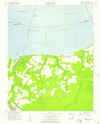
1954 Map of Roper North
USGS Topo · Published 1957About this map
Albemarle Sound dominates the northern half of this coastal survey, where the waters of Edenton and Yeopim converge. The landscape transitions from the open sound to a network of wetlands and agricultural tracts, defined by Chapel Swamp and the drainage of the Newland Canal in the south. The Norfolk Southern railroad cuts through the western edge of the quadrangle, serving the settlement at Mackeys, which features visible pilings and pier ruins along the waterfront.
Find a feature on this map
30 named features on this map. Tap any name to fly to it.
Don’t see what you’re looking for? This feature index may not catch every label — zoom into the map to look around manually.
Map Details
Editions of this 1954 Roper North Map
3 editions found

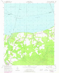
Other maps of this area

1904 · Edenton
USGS Topo · 1:62,500

1906 · Hertford
USGS Topo · 1:62,500

1940 · Hertford
USGS Topo · 1:62,500

1942 · Edenton
USGS Topo · 1:62,500

1943 · Columbia
USGS Topo · 1:125,000

1943 · Plymouth
USGS Topo · 1:125,000

1943 · Edenton
USGS Topo · 1:62,500

1953 · Norfolk
USGS Topo · 1:250,000

1953 · Rocky Mount
USGS Topo · 1:250,000

1954 · Rocky Mount
USGS Topo · 1:250,000