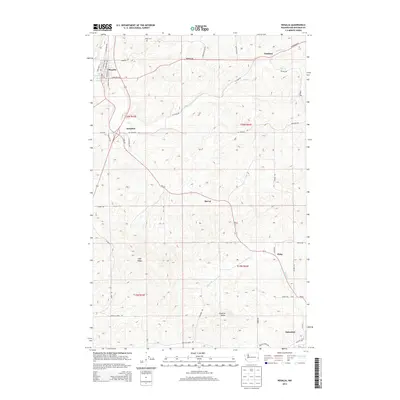
2014 Map of Rosalia
USGS Topo · Published 2014About this map
Rosalia and Oakesdale anchor this portion of the Palouse region, where the landscape is defined by the winding course of Pine Cr and its tributaries. The map details a network of rural settlements including Pandora, Donahue, McCoy, and Flaig, connected by a grid of named local roads. To the north, Riggs Cem sits near the headwaters of Cabbage Cr, serving as a significant point for genealogical research in this agricultural corridor.
Find a feature on this map
48 named features on this map. Tap any name to fly to it.
Don’t see what you’re looking for? This feature index may not catch every label — zoom into the map to look around manually.
Map Details
Editions of this 2014 Rosalia Map
This is the sole edition of this map. No revisions or reprints were ever made.
Other maps of this area

1903 · Oakesdale
USGS Topo · 1:125,000

1905 · Oakesdale
USGS Topo · 1:125,000

1954 · Spangle
USGS Topo · 1:62,500

1954 · Fairfield
USGS Topo · 1:62,500

1955 · Spokane
USGS Topo · 1:250,000

1958 · Spokane
USGS Topo · 1:250,000

1964 · Oakesdale
USGS Topo · 1:24,000

1964 · Malden
USGS Topo · 1:24,000
1964 · Steptoe
USGS Topo · 1:24,000
1964 · Garfield
USGS Topo · 1:24,000