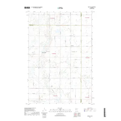
2019 Map of Rose City
USGS Topo · Published 2019About this map
Rose City and the neighboring community of Spruce Center occupy a landscape defined by the convergence of Otter Tail, Douglas, and Todd counties. This late-2010s survey reveals a region shaped by its glacial hydrology, where the Long Prairie River meanders across the southern border and smaller arteries like Stormy Cr and Spruce Creek drain the surrounding wetlands. For genealogists, the map is particularly useful for locating smaller rural burial sites including Scribner Cem, Free Church Cem, and Spruce Hill Cem, which are scattered among the agricultural sections.
Find a feature on this map
50 named features on this map. Tap any name to fly to it.
Don’t see what you’re looking for? This feature index may not catch every label — zoom into the map to look around manually.
Map Details
Editions of this 2019 Rose City Map
This is the sole edition of this map. No revisions or reprints were ever made.
Other maps of this area

1953 · Brainerd
USGS Topo · 1:250,000

1953 · Saint Cloud
USGS Topo · 1:250,000

1957 · Brainerd
USGS Topo · 1:250,000

1957 · Saint Cloud
USGS Topo · 1:250,000

1958 · Saint Cloud
USGS Topo · 1:250,000

1958 · Brainerd
USGS Topo · 1:250,000

1965 · Brainerd
USGS Topo · 1:250,000

1966 · Lake Osakis East
USGS Topo · 1:24,000

1966 · Lake Osakis West
USGS Topo · 1:24,000

1966 · Alexandria East
USGS Topo · 1:24,000