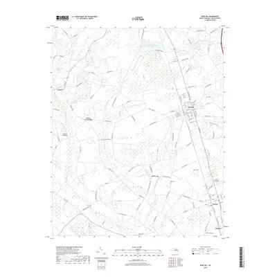
2019 Map of Rose Hill
USGS Topo · Published 2019About this map
Rose Hill and Teachey anchor this Duplin County landscape, defined by a network of agricultural roads and slow-moving coastal plain waterways. The town of Rose Hill shows its established grid east of the railroad, while smaller settlements like Brices Crossroads and Duff Creek dot the surrounding countryside. This 2019 survey documents a terrain where family-named landmarks such as Wells Cem and the extensive Johnsons Lake reflect long-standing ties to the land. Drainage patterns are dominated by Rockfish Cr and its various tributaries like Cabin Br and Miller Cr, which flow through heavily wooded wetlands and tracts such as Rockfish Meadows. The presence of features like Williams Mill Pond and Lake Tub suggests a history of water management for local mills or agriculture, characteristic of the North Carolina interior.
Find a feature on this map
117 named features on this map. Tap any name to fly to it.
Don’t see what you’re looking for? This feature index may not catch every label — zoom into the map to look around manually.
Map Details
Editions of this 2019 Rose Hill Map
This is the sole edition of this map. No revisions or reprints were ever made.
Other maps of this area

1942 · Burgaw
USGS Topo · 1:62,500

1943 · Kenansville
USGS Topo · 1:62,500

1948 · Kenansville
USGS Topo · 1:62,500

1953 · Florence
USGS Topo · 1:250,000

1953 · Beaufort
USGS Topo · 1:250,000

1954 · Florence
USGS Topo · 1:250,000

1954 · Beaufort
USGS Topo · 1:250,000

1955 · Atkinson
USGS Topo · 1:62,500

1962 · Rose Hill
USGS Topo · 1:62,500

1972 · Beaufort
USGS Topo · 1:250,000