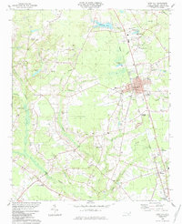
1984 Map of Rose Hill
USGS Topo · Published 1984About this map
Rose Hill and Teachey serve as the primary hubs on this Duplin County landscape, centered on the Seaboard rail line. The terrain is defined by a dense network of blackwater streams and branches, including Rockfish Creek, Taylors Creek, and Island Creek, which dictate the placement of rural settlements like Concord and Brices Crossroads. The 1980s infrastructure is clearly visible through markers like the Radio Tower (WEGG), Jerome Park, and various industrial waste ponds and quarries near the rail corridor.
Find a feature on this map
43 named features on this map. Tap any name to fly to it.
Don’t see what you’re looking for? This feature index may not catch every label — zoom into the map to look around manually.
Map Details
Editions of this 1984 Rose Hill Map
This is the sole edition of this map. No revisions or reprints were ever made.
Other maps of this area

1942 · Burgaw
USGS Topo · 1:62,500

1943 · Kenansville
USGS Topo · 1:62,500

1948 · Kenansville
USGS Topo · 1:62,500

1953 · Florence
USGS Topo · 1:250,000

1953 · Beaufort
USGS Topo · 1:250,000

1954 · Florence
USGS Topo · 1:250,000

1954 · Beaufort
USGS Topo · 1:250,000

1955 · Atkinson
USGS Topo · 1:62,500

1962 · Rose Hill
USGS Topo · 1:62,500

1972 · Beaufort
USGS Topo · 1:250,000