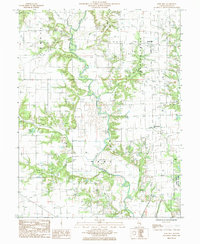
1985 Map of Rose Hill
USGS Topo · Published 1985About this map
The Embarras River meanders through this portion of Jasper County, defining a landscape shaped by agricultural drainage and early resource extraction. Small communities like Rose Hill and Falmouth serve as the primary human nodes in an area where the Abandoned railroad corridor suggests the transition away from mid-century rail-dependent commerce. Evidence of the region's industrial history is visible through several marked Oil Fields scattered across the eastern sections of the quadrangle.
Find a feature on this map
22 named features on this map. Tap any name to fly to it.
Don’t see what you’re looking for? This feature index may not catch every label — zoom into the map to look around manually.
Map Details
Editions of this 1985 Rose Hill Map
This is the sole edition of this map. No revisions or reprints were ever made.
Other maps of this area

1940 · Greenup
USGS Topo · 1:62,500

1941 · Newton
USGS Topo · 1:62,500

1943 · Greenup
USGS Topo · 1:62,500

1943 · Newton
USGS Topo · 1:62,500

1953 · Teutopolis
USGS Topo · 1:62,500

1953 · Sailor Springs
USGS Topo · 1:62,500

1958 · Decatur
USGS Topo · 1:250,000

1958 · Belleville
USGS Topo · 1:250,000

1961 · Decatur
USGS Topo · 1:250,000

1962 · Belleville
USGS Topo · 1:250,000