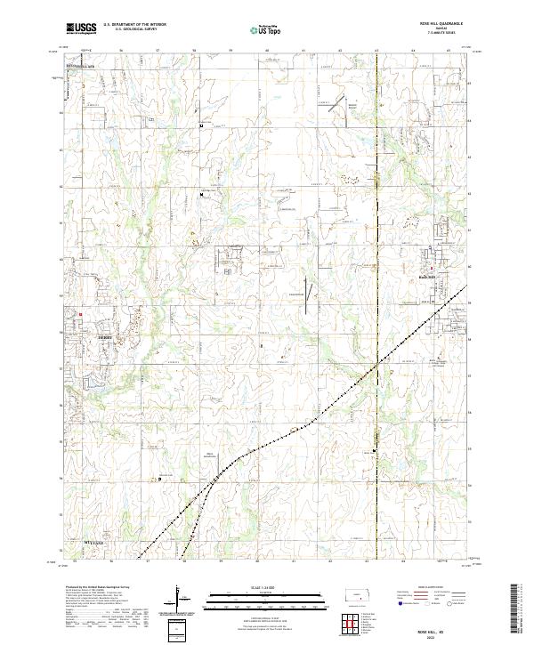
2022 Map of Rose Hill
USGS Topo · Published 2022About this map
The town of Rose Hill sits at the eastern edge of this landscape, where the prairie of south-central Kansas is segmented by a strictly defined grid of county roads and section lines. The map captures the interface of rural agricultural land and growing suburban centers, with the eastern portions of Derby and Mulvane anchoring the western and southwestern corners. Educational and aviation hubs define the local infrastructure, including the Butler Community College - Rose Hill Campus and several small flight facilities such as Cook Airfield and Vankirk Airport. Several drainages, including Eightmile Creek and Polecat Creek, cut diagonally across the terrain, influencing the placement of several local burial grounds like Branson Cemetery and Union Cemetery. This document illustrates the persistent importance of the section-line road system in organizing the modern Kansas countryside.
Find a feature on this map
118 named features on this map. Tap any name to fly to it.
Don’t see what you’re looking for? This feature index may not catch every label — zoom into the map to look around manually.
Map Details
Editions of this 2022 Rose Hill Map
This is the sole edition of this map. No revisions or reprints were ever made.
Other maps of this area

1889 · Wichita
USGS Topo · 1:125,000

1890 · Wellington
USGS Topo · 1:125,000

1894 · Wichita
USGS Topo · 1:125,000

1943 · Wichita East
USGS Topo · 1:31,680

1943 · Derby
USGS Topo · 1:31,680

1945 · Andover
USGS Topo · 1:31,680

1955 · Udall
USGS Topo · 1:24,000

1955 · Belle Plaine
USGS Topo · 1:24,000

1955 · Santa Fe Lake
USGS Topo · 1:24,000

1955 · Rose Hill
USGS Topo · 1:24,000