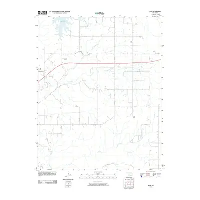
2010 Map of Rose
USGS Topo · Published 2010About this map
Chimney Rock Lake dominates the northwest corner of this landscape, its fingers reaching into the surrounding terrain where the Oklahoma prairie meets the Ozark foothills. The area is defined by a dense network of watercourses including Little Spring Creek, Snake Creek, and Bryant Creek, which dictate the placement of rural homesteads and section-line roads. Small family and community landmarks provide essential points of reference for genealogists, such as Rose Cemetery and Little Rock Cemetery.
Find a feature on this map
30 named features on this map. Tap any name to fly to it.
Don’t see what you’re looking for? This feature index may not catch every label — zoom into the map to look around manually.
Map Details
Editions of this 2010 Rose Map
This is the sole edition of this map. No revisions or reprints were ever made.
Other maps of this area

1896 · Pryor
USGS Topo · 1:125,000

1899 · Siloam Springs
USGS Topo · 1:125,000

1901 · Pryor
USGS Topo · 1:125,000

1903 · Siloam Springs
USGS Topo · 1:125,000

1904 · Siloam Springs
USGS Topo · 1:125,000

1954 · Tulsa
USGS Topo · 1:250,000

1958 · Tulsa
USGS Topo · 1:250,000

1963 · Tulsa
USGS Topo · 1:250,000

1971 · Kenwood
USGS Topo · 1:24,000
1971 · Salina
USGS Topo · 1:24,000