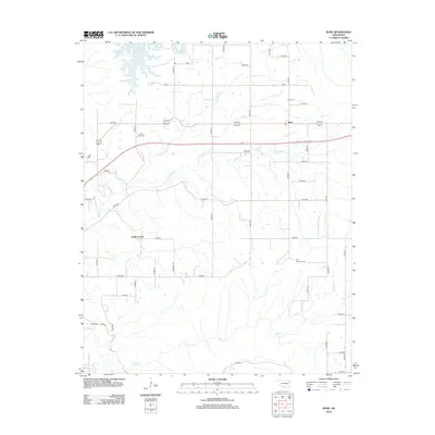
2012 Map of Rose
USGS Topo · Published 2012About this map
Rose stands as the primary settlement in this corner of Mayes County, situated amidst a drainage network defined by Little Spring Cr and the winding course of Snake Cr. The landscape is characterized by its agricultural grid, where numerous rural roads such as e0550 RD and n4480 RD connect scattered homesteads and local landmarks. To the north, the waters of Chimney Rock Lake provide a significant geographical anchor, while the southern reaches are drained by Bryant Cr and Spring Cr. For those tracing local heritage, the map identifies specific burial sites including Rose Cem and Little Rock Cem, alongside the Rose Lookout Tower, which served as a vital high-point marker for the surrounding timber and grasslands during the early 21st century.
Find a feature on this map
41 named features on this map. Tap any name to fly to it.
Don’t see what you’re looking for? This feature index may not catch every label — zoom into the map to look around manually.
Map Details
Editions of this 2012 Rose Map
This is the sole edition of this map. No revisions or reprints were ever made.
Other maps of this area

1896 · Pryor
USGS Topo · 1:125,000

1899 · Siloam Springs
USGS Topo · 1:125,000

1901 · Pryor
USGS Topo · 1:125,000

1903 · Siloam Springs
USGS Topo · 1:125,000

1904 · Siloam Springs
USGS Topo · 1:125,000

1954 · Tulsa
USGS Topo · 1:250,000

1958 · Tulsa
USGS Topo · 1:250,000

1963 · Tulsa
USGS Topo · 1:250,000

1971 · Kenwood
USGS Topo · 1:24,000
1971 · Salina
USGS Topo · 1:24,000