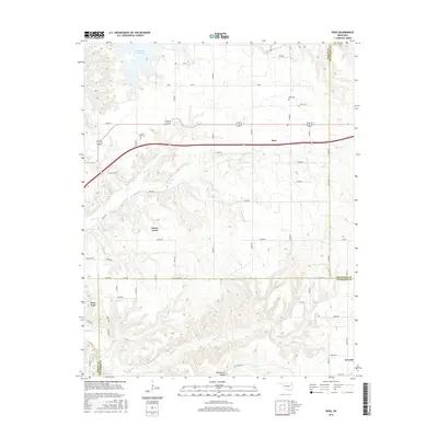
2016 Map of Rose
USGS Topo · Published 2016About this map
Snake Creek and its complex network of tributaries carve through this section of the Ozark plateau where Mayes, Delaware, and Cherokee counties meet. This 2016 survey illustrates the persistent rural character of northeastern Oklahoma, defined by scattered settlements like Rose, Iron Post, and Teresita. The landscape is etched by deep drainages such as Blacksmith Hollow and Bryant Creek, which flow toward larger water bodies like Chimney Rock Lake in the north.
Find a feature on this map
39 named features on this map. Tap any name to fly to it.
Don’t see what you’re looking for? This feature index may not catch every label — zoom into the map to look around manually.
Map Details
Editions of this 2016 Rose Map
This is the sole edition of this map. No revisions or reprints were ever made.
Other maps of this area

1896 · Pryor
USGS Topo · 1:125,000

1899 · Siloam Springs
USGS Topo · 1:125,000

1901 · Pryor
USGS Topo · 1:125,000

1903 · Siloam Springs
USGS Topo · 1:125,000

1904 · Siloam Springs
USGS Topo · 1:125,000

1954 · Tulsa
USGS Topo · 1:250,000

1958 · Tulsa
USGS Topo · 1:250,000

1963 · Tulsa
USGS Topo · 1:250,000

1971 · Kenwood
USGS Topo · 1:24,000
1971 · Salina
USGS Topo · 1:24,000