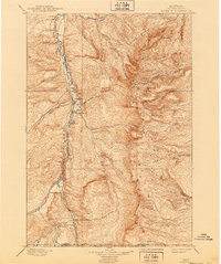
1901 Map of Rosebud
USGS Topo · Published 1940About this map
The Little Big Horn River valley anchors this 1890s reconnaissance survey, illustrating the early settlement patterns of Rosebud County before the turn of the century. The Burlington and Missouri River R. R. runs parallel to the river, connecting a series of small outposts and family holdings such as Sand Hills Ranch, Fortymile Ranch, and Hams Ranch. The landscape is dominated by the Wolf Mountains in the central and eastern portions, where numerous drainages like Rosebud Creek and Corral Creek carve through the high terrain.
Find a feature on this map
26 named features on this map. Tap any name to fly to it.
Don’t see what you’re looking for? This feature index may not catch every label — zoom into the map to look around manually.
Map Details
Editions of this 1901 Rosebud Map
4 editions found
Other maps of this area

1894 · Rosebud
USGS Topo · 1:125,000

1894 · St. Xavier
USGS Topo · 1:125,000

1894 · Fort Custer
USGS Topo · 1:125,000

1895 · Dayton
USGS Topo · 1:125,000

1898 · Bald Mountain
USGS Topo · 1:125,000

1901 · Rosebud
USGS Topo · 1:125,000

1901 · Dayton
USGS Topo · 1:125,000

1901 · St. Xavier
USGS Topo · 1:125,000

1901 · Bald Mountain
USGS Topo · 1:125,000

1909 · Sheridan
USGS Topo · 1:125,000