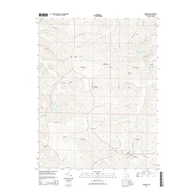
2015 Map of Rosebud
USGS Topo · Published 2015About this map
Rosebud and the smaller community of Drake anchor this Gasconade County landscape, where the headwaters of Boeuf Cr and Langejammer Cr wind through the terrain. The map reveals a dense network of family-named roads, such as Roethemeyer Rd, Aufderheide Rd, and Liesemeyer Rd, which reflect the area's deep-rooted agricultural settlement. Genealogists will find significant value in the numerous burial grounds recorded, including the Saint James United Church of Christ Cemetery and the more remote Matthews Cemetery. The map also identifies local landmarks like the Daizy Vally Reservoir and the Fishing Lake north of Boeuf Cr. These features, alongside small rural hubs like Wiffenberg, provide a clear picture of the mid-Missouri countryside as it appeared during the 2015 update.
Find a feature on this map
58 named features on this map. Tap any name to fly to it.
Don’t see what you’re looking for? This feature index may not catch every label — zoom into the map to look around manually.
Map Details
Editions of this 2015 Rosebud Map
This is the sole edition of this map. No revisions or reprints were ever made.
Other maps of this area

1890 · Hermann
USGS Topo · 1:125,000

1890 · Fulton
USGS Topo · 1:125,000

1903 · Sullivan
USGS Topo · 1:125,000

1934 · Bland
USGS Topo · 1:62,500

1935 · Gerald
USGS Topo · 1:48,000

1935 · Morrison
USGS Topo · 1:48,000

1936 · Hermann
USGS Topo · 1:48,000

1937 · Bland
USGS Topo · 1:62,500

1941 · Gerald
USGS Topo · 1:62,500

1942 · Morrison
USGS Topo · 1:62,500