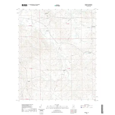
2018 Map of Rosebud
USGS Topo · Published 2018About this map
Fatama and Rosebud anchor this portion of Wilcox County, where the landscape is defined by a dense network of creek drainages and rural roads. The area exhibits a classic Southern settlement pattern with small community hubs like Neenah, Estelle, and Darlington connected by local routes such as McIntosh Rd and Bonner Rd. The hydrology is particularly intricate, with Pursley Cr and its tributaries, including W Prong Pursley Cr and E Prong Pursley Cr, carving through the terrain alongside Pine Barren Creek and Prairie Cr. These watercourses likely influenced the placement of early homesteads and agricultural boundaries. Topographic details reveal the complex ridgelines between these valleys, providing a clear view of the rural Alabama interior as it appeared in the late twenty-teens.
Find a feature on this map
36 named features on this map. Tap any name to fly to it.
Don’t see what you’re looking for? This feature index may not catch every label — zoom into the map to look around manually.
Map Details
Editions of this 2018 Rosebud Map
This is the sole edition of this map. No revisions or reprints were ever made.
Other maps of this area

1953 · Montgomery
USGS Topo · 1:250,000

1953 · Andalusia
USGS Topo · 1:250,000

1956 · Montgomery
USGS Topo · 1:250,000

1957 · Montgomery
USGS Topo · 1:250,000

1957 · Andalusia
USGS Topo · 1:250,000

1957 · Carlowville
USGS Topo · 1:62,500

1973 · Camden South
USGS Topo · 1:24,000

1973 · Vredenburgh
USGS Topo · 1:24,000
1974 · Camden North
USGS Topo · 1:24,000
1981 · Rosebud
USGS Topo · 1:24,000