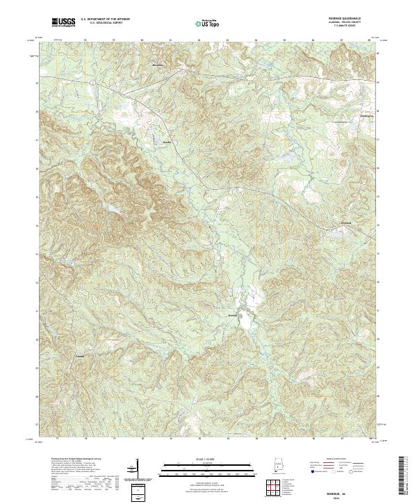
2024 Map of Rosebud
USGS Topo · Published 2024About this map
Pursley Creek and its many branches, including the West Prong Pursley Creek and East Prong Pursley Creek, dominate this portion of Wilcox County. The landscape is defined by the headwaters of several drainages, where Pine Barren Creek and Shoal Creek carve through the terrain. Small rural settlements are scattered across the quadrangle, connected by a network of county roads like Co Rd 51 and Clarence Daily Rd. The map illustrates a contemporary rural Alabama settlement pattern where community identity remains tied to locations such as Rosebud, Fatama, and Neenah. A distinct landmark in the southwestern corner, Fire Tower Rd, suggests the historical importance of forestry management in this heavily wooded region, while names like Estelle and Shawnee mark specific residential pockets along the ridges and creek valleys.
Find a feature on this map
35 named features on this map. Tap any name to fly to it.
Don’t see what you’re looking for? This feature index may not catch every label — zoom into the map to look around manually.
Map Details
Editions of this 2024 Rosebud Map
This is the sole edition of this map. No revisions or reprints were ever made.
Other maps of this area

1953 · Montgomery
USGS Topo · 1:250,000

1953 · Andalusia
USGS Topo · 1:250,000

1956 · Montgomery
USGS Topo · 1:250,000

1957 · Montgomery
USGS Topo · 1:250,000

1957 · Andalusia
USGS Topo · 1:250,000

1957 · Carlowville
USGS Topo · 1:62,500

1973 · Camden South
USGS Topo · 1:24,000

1973 · Vredenburgh
USGS Topo · 1:24,000
1974 · Camden North
USGS Topo · 1:24,000
1981 · Rosebud
USGS Topo · 1:24,000